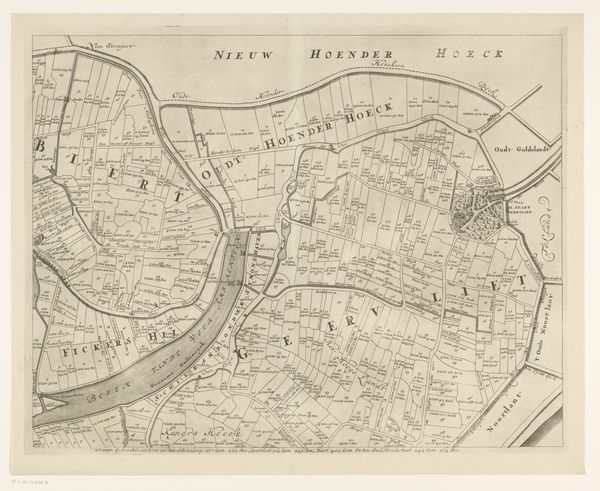
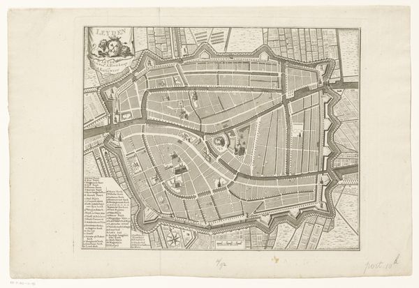
Kaart met een concept voor de bedijking en drooglegging van de Nieuwkoopse Plassen 1791
0:00
0:00
drawing, graphic-art, print, etching
#
drawing
#
graphic-art
#
rippled sketch texture
#
dutch-golden-age
# print
#
etching
#
old engraving style
#
landscape
#
botanical illustration
#
etching
#
linocut print
#
thin linework
#
botanical drawing
#
pen work
#
storyboard and sketchbook work
#
botanical art
Dimensions: height 515 mm, width 628 mm
Copyright: Rijks Museum: Open Domain
Editor: This is “Kaart met een concept voor de bedijking en drooglegging van de Nieuwkoopse Plassen,” or “Map with a concept for the diking and drainage of the Nieuwkoopse Plassen,” created in 1791 by Leonardus Schenk Jansz, made with etching and engraving. It's so detailed! The precision in mapping out this landscape is fascinating. What does this tell us about its historical context? Curator: Well, this piece speaks volumes about the Dutch relationship with land reclamation. Consider that in 1791, the Netherlands was still heavily engaged in its centuries-long battle against the sea. Maps like this weren't just documents; they were instruments of power, envisioning and enabling the control and transformation of the landscape. The very act of mapping a space is an assertion of dominance. Editor: So, it’s a political act as much as a geographical one? How were such projects received by the communities involved? Curator: Precisely. Land reclamation, while often economically driven, drastically altered existing ecologies and disrupted traditional ways of life. These projects, promising fertile land and economic opportunities, were frequently met with resistance from those who depended on the existing wetlands for their livelihoods. This map becomes a fascinating window into the social and political tensions of the time. Do you notice anything about who likely commissioned or benefited from a map like this? Editor: Given its detail, likely landowners or investors keen on understanding the potential of this land? I imagine ordinary people might not have had the means or the need for such a plan. Curator: Exactly. It reveals a hierarchy of power, illustrating whose vision was being prioritized and whose voices might have been marginalized in the process. Understanding who creates and uses imagery allows us to uncover the hidden narratives embedded within these historical records. Editor: It makes me think about how land development continues to be such a contested issue even today. This old map feels surprisingly relevant. Thanks, that's given me a lot to think about!
Comments
No comments
Be the first to comment and join the conversation on the ultimate creative platform.
More like this