drawing, paper, watercolor, ink
#
drawing
#
dutch-golden-age
#
paper
#
watercolor
#
ink
#
coloured pencil
#
geometric
#
cityscape
#
watercolor
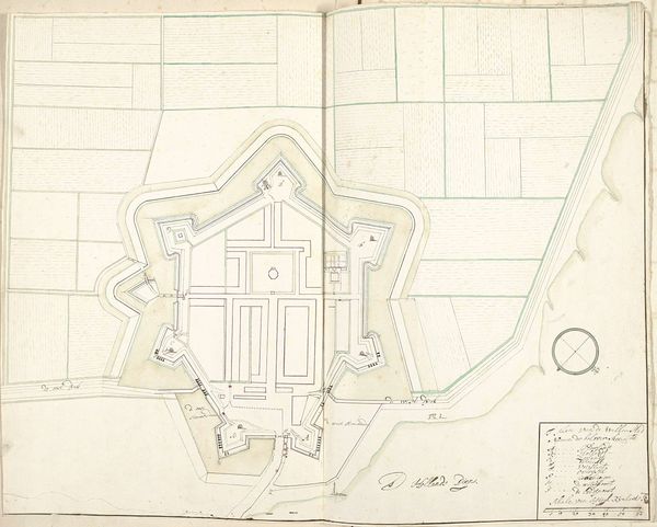
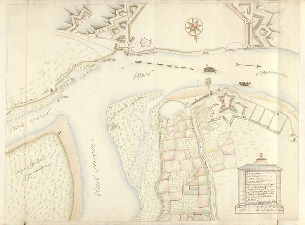
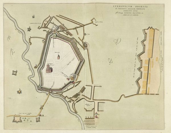
Dimensions: height 525 mm, width 720 mm
Copyright: Rijks Museum: Open Domain
Editor: We're looking at "Plattegrond van Willemstad, 1705" by Arnold Willem van Holthuisen, a drawing in ink and watercolor on paper. The colors are quite muted, but I find the geometry and precision of the lines fascinating. What's your take on it? Curator: Intriguing indeed. Note how Holthuisen emphasizes form through the stark contrasts and delineation of space. The geometric precision you mention, how would you characterize the structural balance achieved? Editor: Well, the fortified city with its star shape dominates the composition, doesn't it? It feels almost like a fortress of reason amidst a more organic landscape. Curator: Precisely. Consider then the interplay between line and color. The rigid grid of fields contrasted with the softer washes of watercolor used to define the waterways and open spaces. Do these visual choices suggest a hierarchy, a visual argument perhaps? Editor: I think so. It feels like the planned, rational city is set apart, even imposed upon, the natural environment surrounding it. But why use such formal and geometric approaches? Curator: Perhaps it emphasizes control and order during a period defined by maritime power and military strategy. Each line seems calculated. Reflect on the map as an object, and as an artifact which carries symbolic weight tied to the urban planning and colonial intent of the time. What overall formal choices contribute to a symbolic, impactful viewing? Editor: That's helpful. I see how Holthuisen used formal techniques to create something beyond a simple map; the image projects the ambition and ideals of that era. Curator: Exactly. It showcases the fusion of artistic representation and strategic design. A keen observation indeed. Editor: Thank you! It's incredible how a focus on form reveals deeper levels of meaning.
Comments
No comments
Be the first to comment and join the conversation on the ultimate creative platform.
More like this