print, engraving
#
dutch-golden-age
# print
#
landscape
#
geometric
#
cityscape
#
engraving
Dimensions: height 467 mm, width 743 mm
Copyright: Rijks Museum: Open Domain
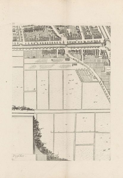
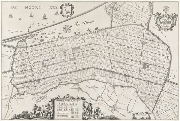
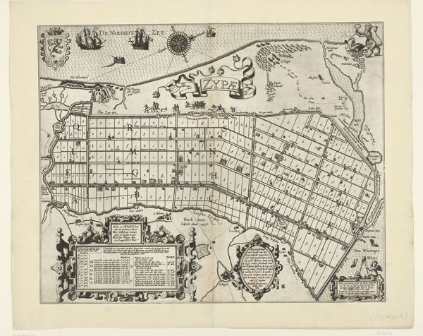
Laurens van Teylingen created this map of the Wormer, using ink, that presents the viewer with an orderly layout, a stark contrast to nature’s inherent chaos. The composition is dominated by precise, vertical lines that delineate individual land parcels. This cartographic representation transforms the landscape into an abstract, almost geometric pattern. The parallel structure of the plot divisions is interrupted only by the curvature of the surrounding waterways. Each segment, uniform in shape, emphasizes standardization and control. The map becomes a visual representation of power, illustrating human attempts to impose order onto the natural world. This visual architecture suggests a semiotic system of signs. It moves beyond mere geographical data, representing a network of social, economic, and political relationships. The visual impact lies in the tension between the grid and the organic curves. This artwork, therefore, functions not only as a navigational tool but as a cultural artifact, reflecting society’s complex interplay with its environment.
Comments
No comments
Be the first to comment and join the conversation on the ultimate creative platform.
More like this