drawing, print, etching
#
drawing
#
baroque
# print
#
etching
#
etching
#
personal sketchbook
#
cityscape
Dimensions: height 420 mm, width 560 mm
Copyright: Rijks Museum: Open Domain
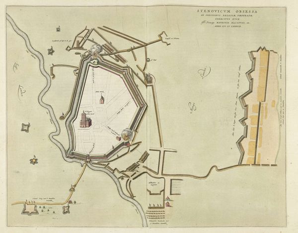
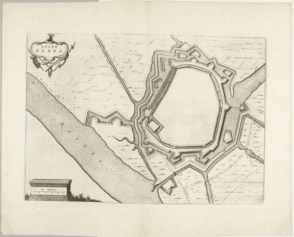
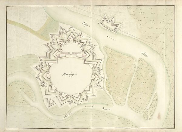
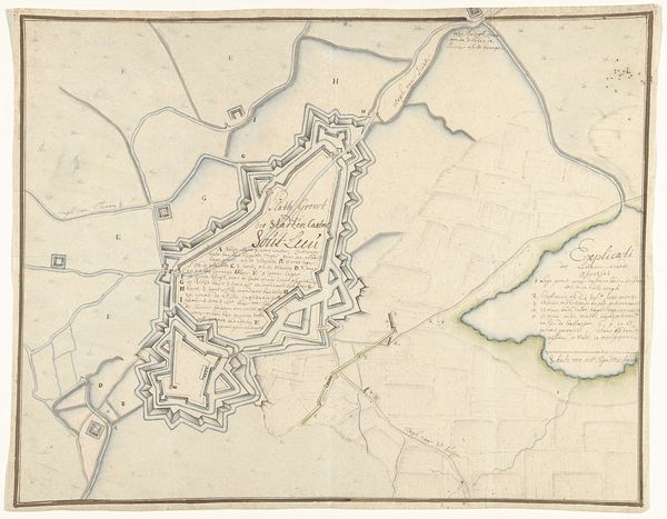
Editor: Here we have a drawing titled "Plattegrond van Kortrijk, 1706" by Samuel Du Ry de Champdoré, created sometime between 1706 and 1712, utilizing print and etching. It seems to be a cityscape, perhaps a map? I'm struck by its intricacy, all those lines forming such a defined structure. What’s your interpretation of this piece? Curator: Indeed, this meticulously rendered etching presents us with more than just a map; it’s a carefully constructed statement of power and control. This is a Baroque era depiction of Kortrijk, a city strategically important, given its location. Editor: How so? Curator: Consider the prominent fortifications, their elaborate angles and placements – all designed to project military strength. These weren't just defensive structures; they were symbols of authority in a politically turbulent Europe. Editor: I see, it’s about asserting dominance. So, what purpose would a map like this serve back then? Was it purely functional, for military planning, or something more? Curator: It served both pragmatic and propagandistic functions. It aided military strategists, yes, but also visually communicated the might and sophistication of the controlling power. Note how even in representing space, the landscape itself becomes an argument for control, visibility and strategic planning becoming aesthetic values. The 'Cityscape' isn't neutral, it is entirely framed for a viewer to have control, isn't it? Editor: Absolutely! It reframes how I view maps now, not just as practical guides but as instruments of power, projecting political ambitions. Thanks! Curator: My pleasure! Analyzing such cartographic works helps us decode how even seemingly objective representations are steeped in social and political intention. It certainly enriches our understanding of art's broader impact.
Comments
No comments
Be the first to comment and join the conversation on the ultimate creative platform.
More like this