drawing, print, paper, ink, engraving
drawing
baroque
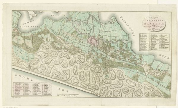
landscape
paper
ink
cityscape
history-painting
engraving
Dimensions: height 450 mm, width 560 mm
Copyright: Rijks Museum: Open Domain
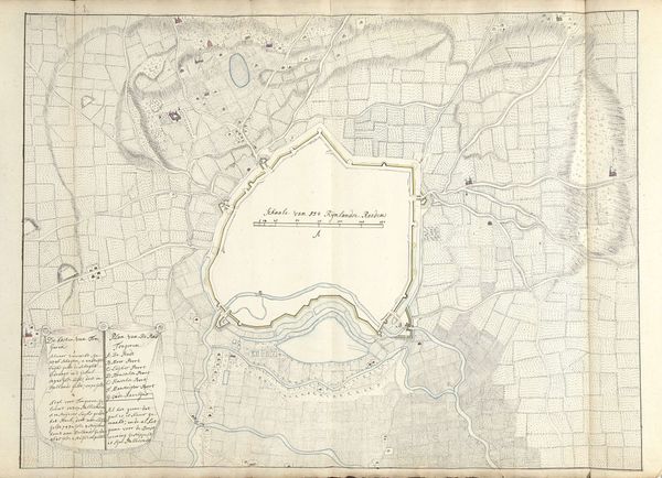
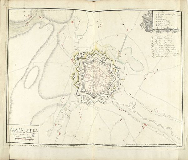
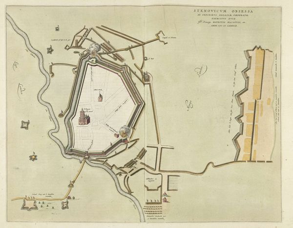
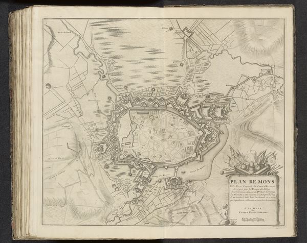
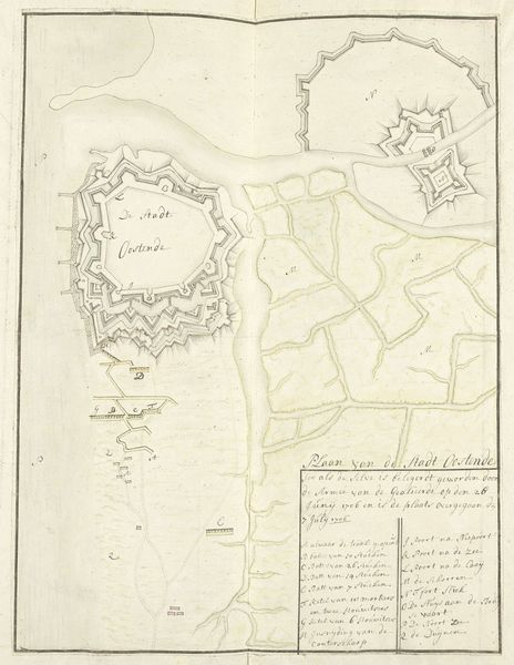
Editor: Here we have Samuel Du Ry de Champdoré’s "Plattegrond van Oudenaarde, 1707", a print and ink drawing on paper. It looks like a map of a city. What strikes me is how geometric it all is; it looks like a star. What story does this plan tell? Curator: Indeed. The star-like design you observe reflects a very particular moment in military and urban history. These bastioned fortifications were fashionable from the 16th through the 18th centuries as defenses against cannon fire. These forms are less about beauty, and more about protection against emergent weaponry of the time. Editor: So, the shape was dictated by technology, not aesthetics? Curator: Precisely. The lines of fire could overlap, covering all possible approaches to the city. Think about the resources and power necessary to build and maintain such a structure! These images promoted a very specific vision of state power. Editor: It's amazing how a seemingly straightforward map can be so loaded with social and political meaning. Looking closer, I also see the carefully depicted landscape surrounding the city. Is there significance to what lies outside the walls? Curator: Absolutely. The surrounding landscape – the fields, rivers, even the distant hills – played a vital role in both the city’s sustenance and its defense. Control of these areas would be crucial in a siege, influencing who would ultimately win. Who controlled the food supply? The water supply? This map is more than just directions; it is about military power. Editor: That’s fascinating; I never would have looked at a map as a piece about “power”. Curator: That's the beauty of studying art history; you learn to "read" images within their specific historical contexts. What looks like a simple city plan speaks volumes about 18th-century warfare and governance. Editor: Thanks; I will never see maps the same way.
Comments
No comments
Be the first to comment and join the conversation on the ultimate creative platform.
More like this