drawing, ink, pen
#
drawing
#
baroque
#
pen sketch
#
landscape
#
ink
#
pen work
#
pen
#
cityscape
#
history-painting
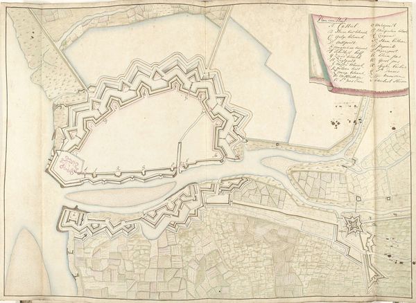
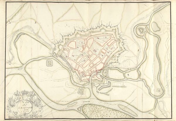
Dimensions: height 528 mm, width 730 mm
Copyright: Rijks Museum: Open Domain
Editor: This detailed pen and ink drawing, "Plattegrond van Sas-van-Gent, 1705," by Arent van Tongeren, shows a cityscape rendered in meticulous detail. It's giving me very controlled, almost architectural vibes. What strikes you most when you look at this plan? Curator: You know, it reminds me of childhood. Did you ever draw elaborate forts, dreaming of sieges and secret passages? There's that same feeling of intricate design hiding untold stories. It’s a map, yes, but look closer. See how the lines, though precise, have a delicate wobble? It hints at the hand that held the pen, a real person observing, measuring, and also, perhaps, imagining. What do you think that personal touch adds? Editor: I think it gives a sense of humanity. It reminds you that it’s more than just data. Curator: Precisely. This was a period of massive fortifications. It's strategic planning, but also a statement. "We are here, and we are prepared.” But consider what isn't shown. Where are the people? The bustling market squares, the tiny gardens? Their absence whispers about the primary purpose: defense, and control. This city, beautiful as it is on paper, exists almost solely as a military machine. Does knowing that change how you see the image? Editor: Definitely. It's almost like a ghost city, all structure and no life. I'll never look at a map the same way again. Curator: Maybe that's the power of art: to see beyond the surface, beyond the stated purpose, and find the beating heart of an era, even in a map.
Comments
No comments
Be the first to comment and join the conversation on the ultimate creative platform.
More like this