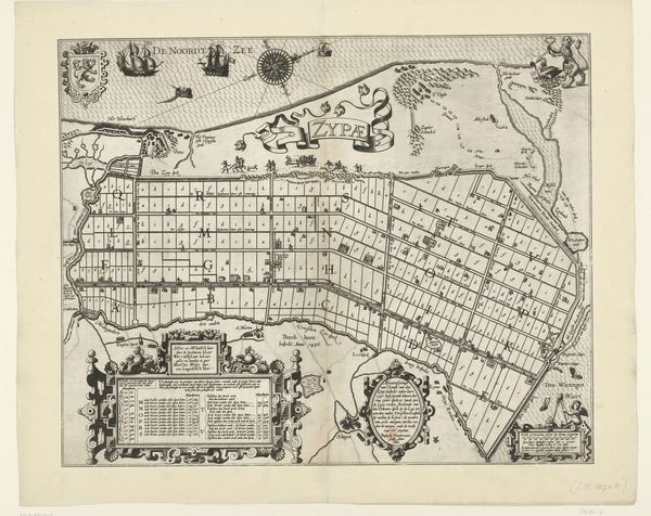
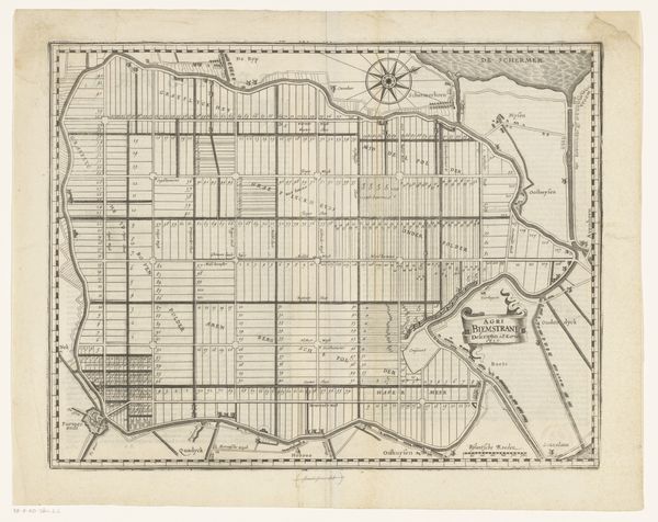
Kaart van de Schermer na voltooiing van de bedijking en verloting van de kavels, 1635 before 1640
0:00
0:00
drawing, print, engraving
#
architectural sketch
#
drawing
#
map drawing
#
dutch-golden-age
# print
#
old engraving style
#
architectural diagram
#
architectural plan
#
architectural section drawing
#
architectural drawing
#
architecture drawing
#
architectural proposal
#
storyboard and sketchbook work
#
engraving
Dimensions: height 508 mm, width 639 mm
Copyright: Rijks Museum: Open Domain
Salomon Rogiers produced this etching in 1635, titled "Kaart van de Schermer na voltooiing van de bedijking en verloting van de kavels," meaning "Map of the Schermer after completion of the embankment and lottery of the plots". Observe how Rogiers' composition employs precise, linear forms to map the newly reclaimed Schermer area. The network of fine lines and geometric shapes carves the landscape into an organized grid of parcels. The land, neatly divided, suggests control and a rational ordering of space, visually mirroring the social engineering of the time. The map isn't just a representation; it's a statement about transforming nature into a structured, legible form that speaks to the era's fascination with categorization and control. The map’s aesthetic is not just utilitarian. It’s a reflection of a worldview, where nature is something to be measured, divided, and understood through a system of signs and symbols. It is a testament to our enduring impulse to impose order on the world around us.
Comments
No comments
Be the first to comment and join the conversation on the ultimate creative platform.
More like this