print, etching
#
baroque
# print
#
etching
#
etching
#
cityscape
#
history-painting
Dimensions: height 826 mm, width 1145 mm
Copyright: Rijks Museum: Open Domain
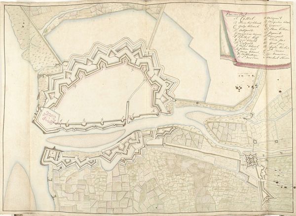
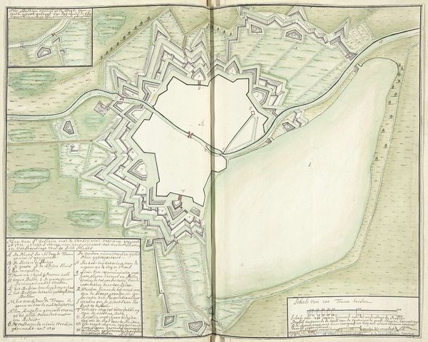
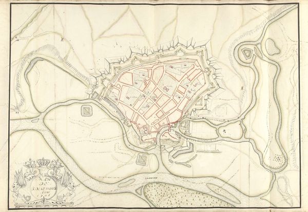
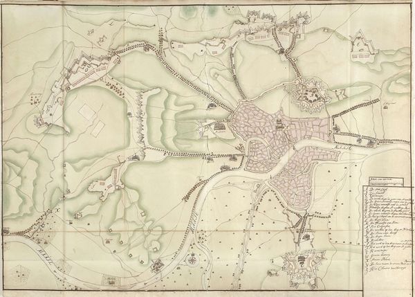
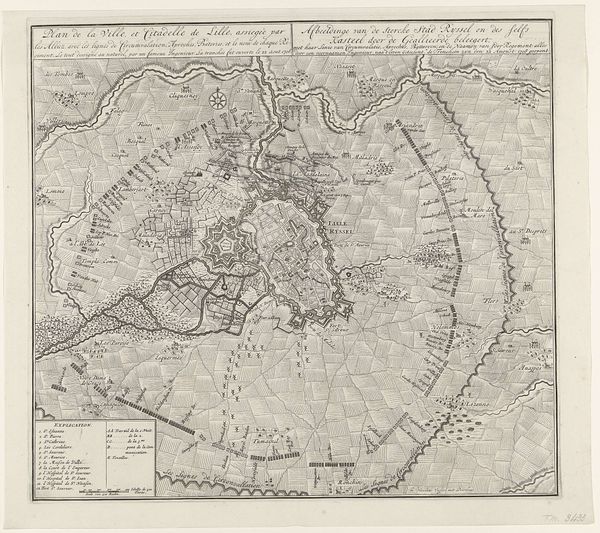
In 1710, Samuel Du Ry de Champdoré meticulously drafted this plan of Amiens. Notice the star-shaped fortifications surrounding the city, a motif that echoes through the ages. This design isn't unique to Amiens, but a recurring symbol of military architecture, seen in fortresses across Europe and beyond. The star fort, with its angular bastions, emerged in the 15th century, a direct response to the rise of gunpowder artillery. Each point was strategically placed to allow defenders to cover all angles, maximizing defensive capabilities. This shape—a symbol of protection and power—is a direct evolution of the medieval castle walls. Think of how mandalas mirror the geometry of defensive fortifications, reflecting a deep-seated human desire for order and protection against perceived chaos. Like the mandala, the star fort offers not only physical security but also a psychological reassurance. As you delve deeper into the history of fortification, you realize that the star fort is not just a military structure but a potent symbol, continually reborn in the face of evolving threats.
Comments
No comments
Be the first to comment and join the conversation on the ultimate creative platform.
More like this