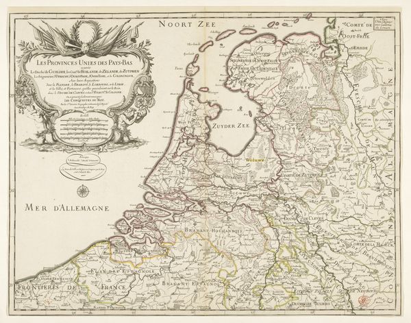
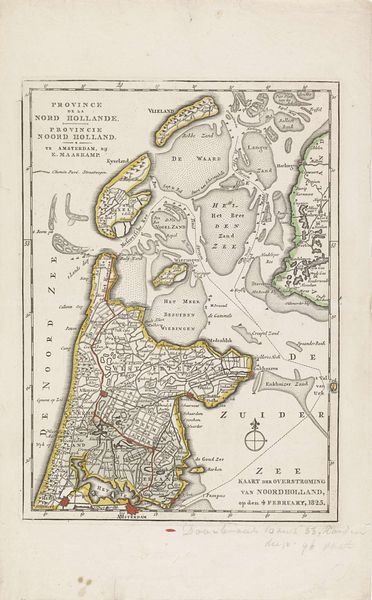
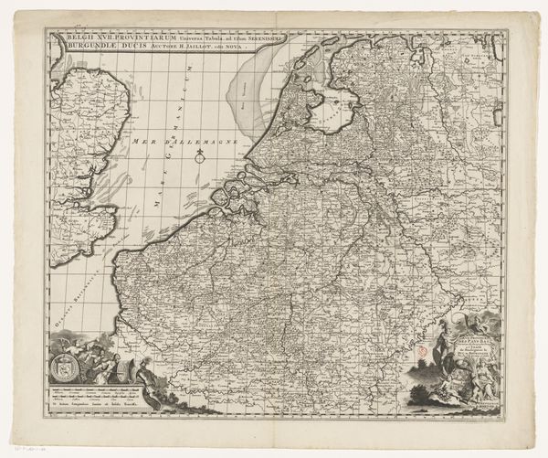
Kaart van de gebieden rond de Zuiderzee getroffen door de watersnood van 1825 1825 - 1826
0:00
0:00
danieliiveelwaard
Rijksmuseum
print, engraving
# print
#
landscape
#
history-painting
#
engraving
Dimensions: height 690 mm, width 620 mm
Copyright: Rijks Museum: Open Domain
Editor: This is "Kaart van de gebieden rond de Zuiderzee getroffen door de watersnood van 1825," a map created between 1825 and 1826 by Daniël (II) Veelwaard. It's an engraving, currently held at the Rijksmuseum. It's a rather sobering image, depicting the areas affected by the flood. What story does this map tell you? Curator: It tells a potent story about human vulnerability and the political response to natural disasters. Beyond being a geographical record, it’s a piece of public history. Consider how this map functions as both a commemorative object and a piece of propaganda, potentially influencing public opinion and resource allocation in the wake of the Zuiderzee flood. It subtly highlights the affected areas but could also indirectly showcase the efforts of those in power to respond to the crisis. Editor: So, it's not just about showing what was lost? Curator: Precisely. It’s about shaping a narrative. Think about who commissioned this map, who was intended to view it, and what messages they might have received. Maps, historically, were powerful tools of statecraft and social control. How do you think the inclusion and exclusion of specific details may have influenced viewers? Editor: I hadn't considered the selection of details as a form of messaging! It’s like, every line and name has a purpose beyond just geographical accuracy. Curator: Exactly. It encourages us to analyze whose perspectives are amplified, and which are silenced, by its very design. Editor: It changes my perspective seeing this piece as something that communicates beyond just the basic cartography! Thanks for highlighting the historical layers embedded within this engraving. Curator: Indeed! Seeing art in its social context makes it much more interesting.
Comments
No comments
Be the first to comment and join the conversation on the ultimate creative platform.
More like this