drawing, lithograph, print, paper, ink, engraving
#
drawing
#
neoclassicism
#
lithograph
# print
#
landscape
#
paper
#
ink
#
geometric
#
engraving
Dimensions: height 727 mm, width 500 mm
Copyright: Rijks Museum: Open Domain
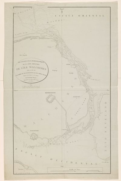
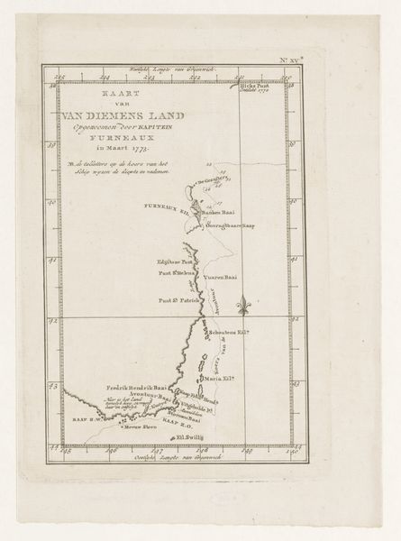
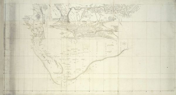
Cornelis van Baarsel created this map of Bass Strait, using ink, around the turn of the 19th century. Maps, such as this one, present us with the potent symbol of orientation, guiding not only physical journeys but also cognitive and cultural understanding. Consider the gridlines, which have appeared throughout history in various forms, from ancient city planning to Renaissance perspective drawings. The grid symbolizes order and control, a means of imposing structure upon the natural world, or, as we see here, the charting of unknown territories. The act of mapping has ancient roots, seen in Paleolithic cave paintings depicting constellations. Maps, in their essence, are manifestations of humanity's urge to understand and codify the world. This urge persists through time. The psychological impact of such visual representations is profound, offering viewers a sense of mastery and knowledge, assuaging our fears of the unknown by reducing the complexities of geography to comprehensible forms. Maps, therefore, aren't just geographical tools; they are psychological and cultural artifacts. They reflect our deepest desires to explore, understand, and, ultimately, control our environment. The power of such symbols lies in their enduring capacity to evolve with us, resurfacing and adapting to different contexts throughout time.
Comments
No comments
Be the first to comment and join the conversation on the ultimate creative platform.
More like this