drawing, print, paper, engraving
#
drawing
# print
#
asian-art
#
old engraving style
#
landscape
#
paper
#
engraving
Dimensions: height 507 mm, width 655 mm
Copyright: Rijks Museum: Open Domain
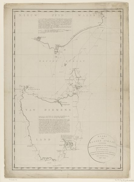
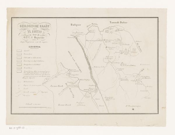
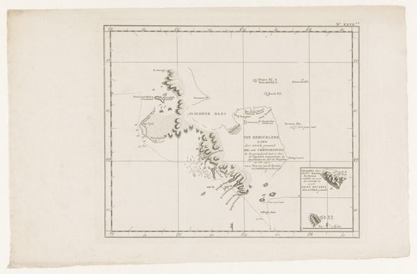
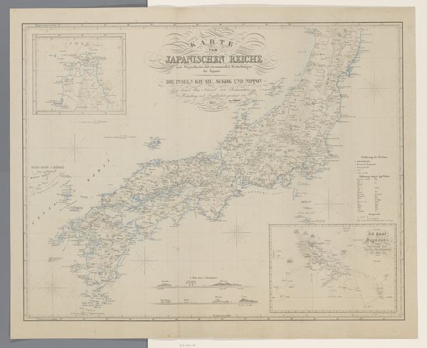
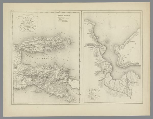
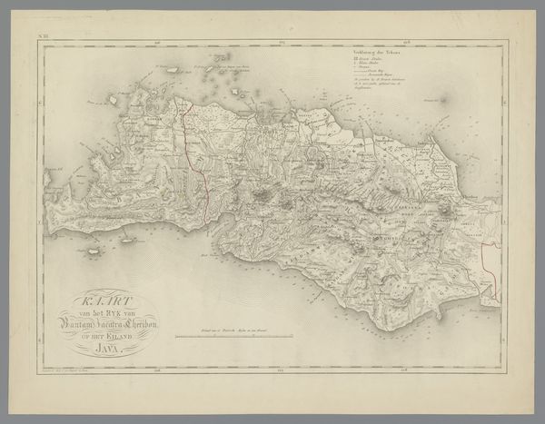
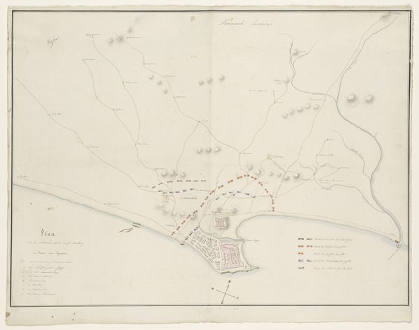
This is P.C. Tesch's map, "Zeekaart van de Straat van Taiwan of Straat Formosa." The map's design emphasizes the geometric layout of geographical data, where precise lines and ordered text reflect a rationalized view of the world. The composition is dominated by the contrast between the stark, empty sea and the detailed coastlines. This sharp distinction creates a visual hierarchy, guiding our focus to the structured depiction of landmasses. The map uses typography as a key element to convey information, which reflects a semiotic system. The formal arrangement of the names mirrors the then-current Western understanding of the region. This structured presentation imposes a colonial order onto the landscape. The map is more than a neutral depiction of geography. It embodies a specific perspective that reflects the values and power dynamics of its time. It invites us to question how even seemingly objective forms of representation are embedded with cultural meaning.
Comments
No comments
Be the first to comment and join the conversation on the ultimate creative platform.
More like this