drawing, print, paper, engraving
#
drawing
#
neoclassicism
# print
#
landscape
#
paper
#
geometric
#
engraving
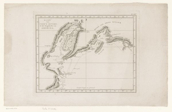
Dimensions: height 290 mm, width 446 mm
Copyright: Rijks Museum: Open Domain
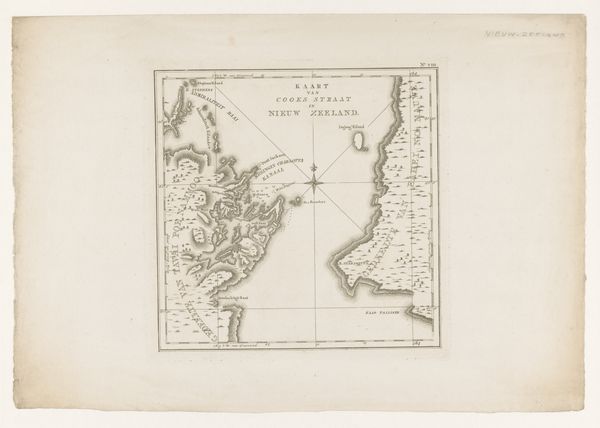
Editor: Here we have a rather lovely print titled "Kaart van drie baaien in Nieuw-Zeeland," or "Map of Three Bays in New Zealand," created in 1797 by an anonymous artist. It's rendered in engraving on paper. It strikes me as so precise, so controlled. It feels less like art and more like… well, mapping! What catches your eye? Curator: Ah, a map! But it's so much more, isn't it? To me, it’s like holding a whisper of history in your hands. Think about the Age of Exploration. Each carefully etched line, each tiny number, represents a daring voyage, a dance between knowledge and the unknown. What does it *feel* like to look at the unknown, sketched with what you already know? It’s quite humbling, wouldn't you say? Editor: Definitely. It does give a sense of that era... What about the geometric shapes that define the bays themselves? Curator: Precisely! Geometry isn't just math; it's a way of imposing order onto the wildness of nature. It's like the artist is saying, "I understand this place. I can tame it, at least on paper." But I wonder, does that taming truly capture the spirit of the bays? Is something lost in the translation from experience to representation? Maybe beauty thrives on chaos? Editor: That’s a cool thought! It does make me wonder what the actual experience of navigating those bays was like for those explorers, compared to this very neat depiction. Curator: Right! So, do we see just a map, or a conversation between control and freedom, the known and the mysterious? Editor: I guess both. Seeing that tension makes it far more interesting than just a simple geographic document. Thanks for the insights. Curator: My pleasure. It is the push and pull of ideas that truly makes art sing!
Comments
No comments
Be the first to comment and join the conversation on the ultimate creative platform.
More like this