print, etching
#
dutch-golden-age
# print
#
etching
#
etching
#
geometric
#
orientalism
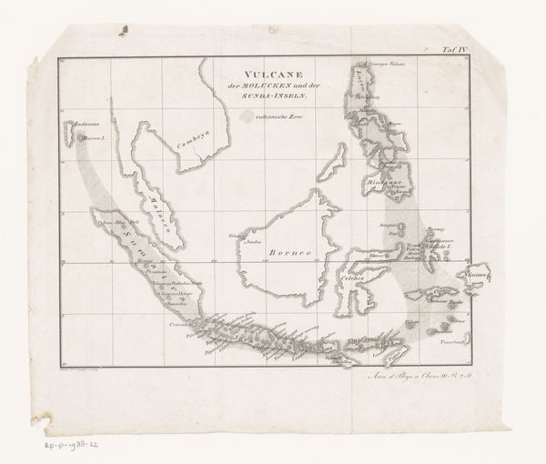
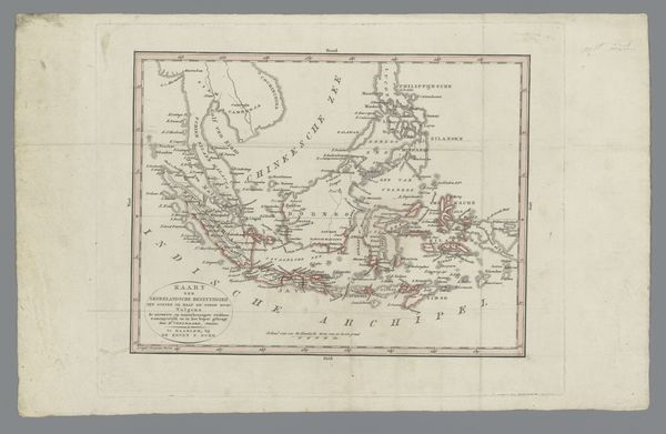
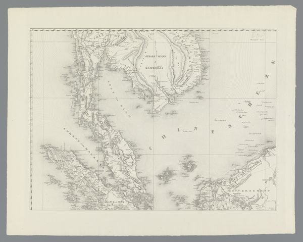
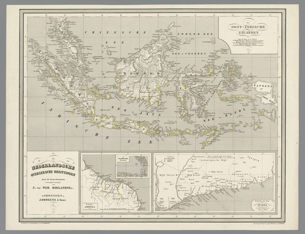
Dimensions: height 405 mm, width 695 mm
Copyright: Rijks Museum: Open Domain
Editor: Here we have Daniël Veelwaard’s “Kaart van de voormalige kolonie Nederlands-Indië,” an etching from 1843, a map of the former Dutch colony, now Indonesia. It’s incredibly detailed and precise, but also unsettling somehow, especially knowing its purpose. What stories do you think it holds? Curator: This map is a stark reminder of the power dynamics inherent in colonialism. Cartography wasn't just about accurately representing geography; it was a tool used to legitimize and enforce colonial control. Who gets to define the boundaries, who gets to name the places – these acts are all loaded with political implications. What does it mean to see this territory, this collection of islands, rendered as a possession? Editor: It feels very clinical, devoid of the human element, almost like the land is just an empty space waiting to be filled. Curator: Precisely. The visual language of maps can be deceptively objective, but we must consider the gaze behind them. This map flattens the diverse realities of the archipelago, reducing complex societies and cultures to mere resources on a colonial chessboard. How do you think the original inhabitants of these lands might have perceived this representation of their home? Editor: I imagine they wouldn't recognize themselves in it, or feel their experiences reflected. It would be an alienating representation. It really makes you think about how we represent places and people, and the responsibilities that come with that. Curator: Exactly. By examining historical artifacts like this, we can unpack the legacies of colonialism and challenge the dominant narratives that continue to shape our understanding of the world. We need to ask ourselves, whose voices are missing from this map, and how can we amplify them? Editor: I'll definitely look at maps differently now. I appreciate seeing it in this light. Curator: And I hope we continue to challenge these kinds of narratives wherever they appear!
Comments
No comments
Be the first to comment and join the conversation on the ultimate creative platform.
More like this