print, etching, engraving
# print
#
etching
#
asian-art
#
etching
#
geometric
#
orientalism
#
line
#
pen work
#
history-painting
#
engraving
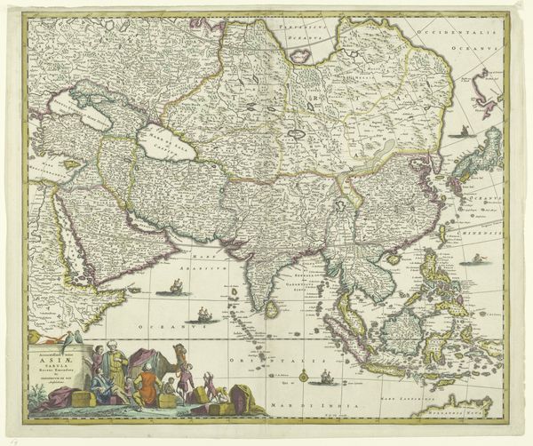
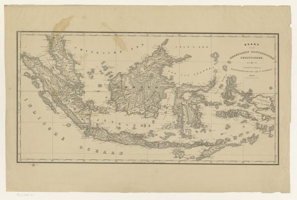
Dimensions: height 458 mm, width 568 mm
Copyright: Rijks Museum: Open Domain
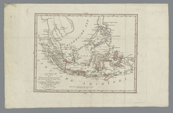
Editor: Here we have "Kaart van Indonesië," or a Map of Indonesia, dating from between 1662 and 1696 by Joannes L'Huilier. It’s a print using etching and engraving. It's fascinating how they represented geographical space at that time! What resonates with you when you look at it? Curator: Well, maps have always been powerful icons, haven't they? More than just geographical tools, they are encoded with cultural assumptions, political agendas, and, importantly, dreams of empire. Look closely – what kind of message is communicated? What kind of people are these mapmakers? Editor: I see… You mean, how accurate it is isn't the only important thing? Curator: Exactly! Think about the 'terra incognita' sections often left blank, sometimes filled with monsters, symbolizing both the fear of the unknown and a challenge to explore and conquer. And here, the figures adorning the map. What do they tell us about the relationship between Europe and this region of Asia? The images suggest the mindset that helped empires expand by 'illustrating' cultural perspectives. What do these choices reveal? Editor: The figures look a little…romanticized, maybe? It’s like they are meant to symbolize the exotic nature of the region. Curator: Precisely. And notice how Indonesia is framed within a larger region, with its relationship to surrounding waters. Water connects these lands, facilitates both trade and conquest. Editor: That's really interesting. So a map is never just a map, is it? Curator: Never. It’s a potent cultural artifact, layered with meanings and assumptions that reveal more about the mapmaker's world than the territory itself. Looking at this today we see how historical cartography leaves a fascinating symbolic archive. Editor: I hadn’t considered that. I'll never look at a map the same way again! Curator: Nor will I! The layers of history are all part of its meaning today.
Comments
No comments
Be the first to comment and join the conversation on the ultimate creative platform.
More like this