graphic-art, print, paper, engraving
#
graphic-art
#
16_19th-century
# print
#
landscape
#
paper
#
engraving
Dimensions: height 400 mm, width 535 mm
Copyright: Rijks Museum: Open Domain
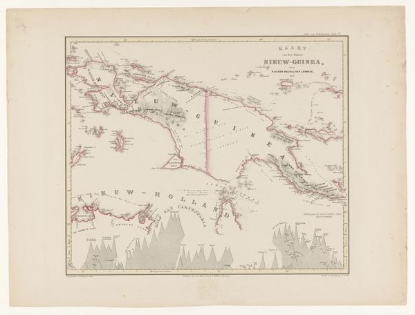
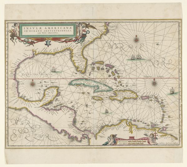
This is F. Cronenberg's "Map of Dutch Possessions in New Guinea". Cartography has always been as much about power as it is about geography. Looking at this map, consider the colonial context of its creation. It represents not just a place, but a claim, an assertion of control over land and people. The map was made during a period of European expansion, when the idea of owning and governing distant lands was a source of national pride and economic ambition. How does the map make you feel? Are you invited into a world of discovery, or are you reminded of the impositions on the indigenous populations of New Guinea? Maps like this are never neutral. They reflect the values and intentions of their makers, and they shape the way we see the world. This map offers us an opportunity to reflect on the legacy of colonialism and its ongoing impact on identity, culture, and power.
Comments
No comments
Be the first to comment and join the conversation on the ultimate creative platform.
More like this