painting, print, watercolor
#
painting
# print
#
landscape
#
watercolor
#
orientalism
#
watercolor
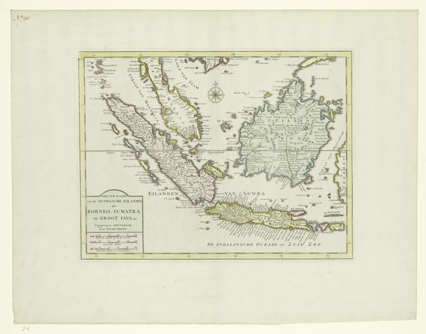
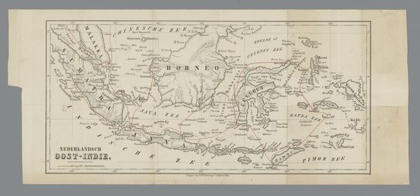
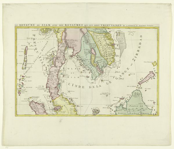
Dimensions: height 233 mm, width 292 mm
Copyright: Rijks Museum: Open Domain
Curator: Here we have “Kaart van Indonesië,” a map of Indonesia created sometime between 1806 and 1868. It's presented as a print with watercolor, currently held in the Rijksmuseum collection and attributed to Daniël (II) Veelwaard. Editor: It strikes me as almost a phantom landscape. Those soft watercolor washes create a hazy, dreamlike version of the islands. Like peering back into history through a delicate veil. Curator: Indeed. Maps of this era were never neutral; they were deeply enmeshed with colonial ambition. This particular map provides a visualisation of Dutch territorial claims and growing interests in the region. Editor: So, it's less about objective geography and more about staking a claim, putting down a marker. I can see that. Even the delicate execution, that precision... it's asserting control in its own way. Almost like, "We know this land; we've charted it, and thus it's ours". Curator: Precisely. Think of the institutional authority underpinning its production. Surveyors, cartographers, printing houses all contributing to this visual declaration. It’s part of a larger European 'Orientalist' project. Editor: So there’s this claim to understanding – a claim to possess not just the land, but also the knowledge of the land and, by extension, its people. It's unsettlingly beautiful, knowing the subtext. The visual appeal works to disguise the power dynamics. Curator: The choice of medium even becomes relevant. The delicacy of watercolor perhaps intended to mask the often-brutal realities of colonial expansion and subjugation that took place within these “charted” boundaries. Editor: The artist in me almost wants to pick it apart and reassemble it as something… more truthful. Acknowledging the shadows. It makes me think about maps and the stories they hide, and the ones they purposefully erase. It's beautiful yet unsettling. Curator: A sentiment entirely in line with the critical engagement we hope visitors will experience. Thanks for helping bring all of that to light today! Editor: My pleasure. Now if only this map could tell us what those islands really thought about all the "charting."
Comments
No comments
Be the first to comment and join the conversation on the ultimate creative platform.
More like this