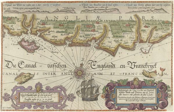
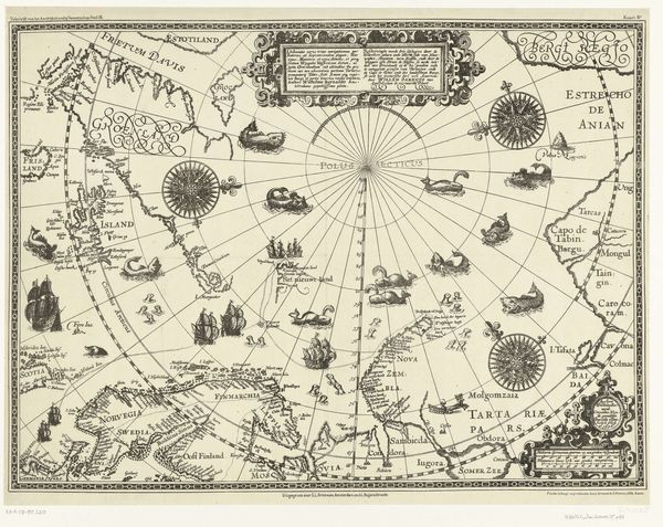
Kaart van de noordkust van Engeland bij Newcastle upon Tyne 1580 - 1583
0:00
0:00
joannesvanidoetechum
Rijksmuseum
print, engraving
# print
#
landscape
#
line
#
northern-renaissance
#
engraving
#
realism
Dimensions: height 330 mm, width 513 mm
Copyright: Rijks Museum: Open Domain
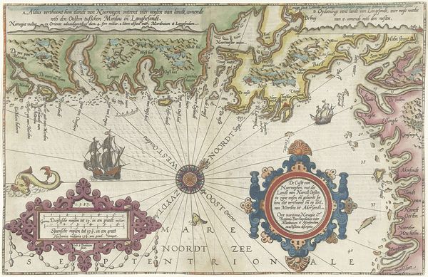
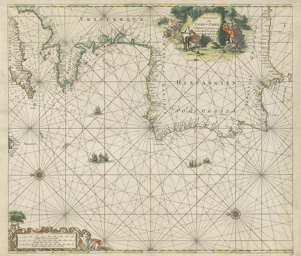
Curator: Here we have “Kaart van de noordkust van Engeland bij Newcastle upon Tyne,” or "Map of the North Coast of England near Newcastle upon Tyne," created between 1580 and 1583 by Joannes van (I) Doetechum. It’s currently held at the Rijksmuseum. Editor: My first impression is one of trade and travel – the wind rose dominating the composition, all those sturdy ships braving the Noordzee. It evokes a sense of a bustling, if dangerous, maritime economy. Curator: Absolutely. Maps weren't just about geographic accuracy, they were powerful symbols of trade, empire, and knowledge. The prominent placement of the compass rose literally directs that power. Consider how the coastline is rendered; its precision signals increasing control over the seas through cartography. Editor: Precisely. Looking at the engraving, you can see how the detail is concentrated around the coastline and the ships themselves. The land almost seems secondary, its economic and military value contingent on access via the sea. And look at the rendering of those ships— such exquisite detail etched into the plate. What would the copper source have been? Was it mined locally, and who would the craftsman have been who undertook the engraving? Curator: That speaks to the tension between artistic skill and utility inherent in mapmaking. It also reminds us that these weren't mass-produced in the way we think of prints today. Each one required skill and labor. And I am struck by the almost decorative element - those flourishes framing cartouches and the scale. Editor: And yet those flourishes are also deeply tied to material concerns. The frame probably aided in mounting the map, providing physical support for it as it was transported and consulted. This was as much a functional object as a representation of power. It’s like a fusion of craft and navigational tool. Curator: Thinking about symbols beyond the literal locations, the inclusion of sea monsters could signal the fear of the unknown—a space "beyond the map" where anxieties about the limits of exploration could be projected. Editor: I am equally moved by the sea monster motif, though it seems the engraver may have been inspired by illustrations in bestiaries of the day; so, although fearful in symbolism, the production relies on other images for guidance. What that suggests to me is an exciting conversation about this print as being embedded within an established print market culture, rather than as an act of independent discovery. Curator: These maps provide so much more than geographic information – they truly show the meeting of exploration, craft, and symbolism from centuries ago. Editor: A potent combination—skillfully rendering a specific time.
Comments
No comments
Be the first to comment and join the conversation on the ultimate creative platform.
More like this