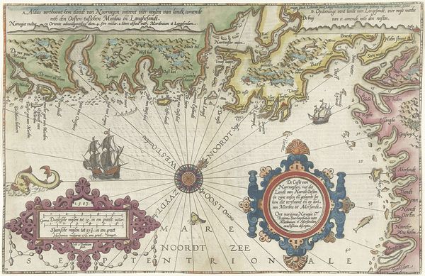
Kaart van de landen rond de poolcirkel met de drie reizen van de Nederlanders, 1598 1878
0:00
0:00
drawing, print, engraving
#
drawing
#
pen drawing
# print
#
landscape
#
11_renaissance
#
geometric
#
engraving
Dimensions: height 435 mm, width 565 mm
Copyright: Rijks Museum: Open Domain
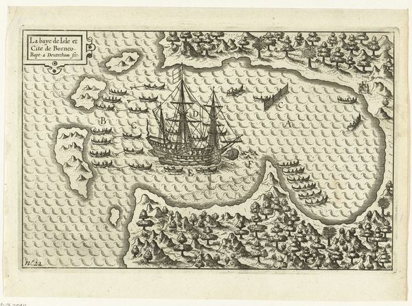
Editor: This print, "Kaart van de landen rond de poolcirkel met de drie reizen van de Nederlanders, 1598," produced around 1878, offers a fascinating glimpse into early cartography. I'm struck by the imagined geography and the strange sea creatures dotted around the Arctic. What sort of images and ideas were being projected here? Curator: Indeed! What you see is a symbolic rendering as much as a geographical one. The map isn't just presenting space; it’s also charting anxieties, hopes, and the spirit of exploration. Those sea monsters, for example—do they strike you as purely decorative? Editor: No, not really. They feel like warnings, maybe filling the unknown with something… else. Curator: Exactly! Consider the role of the unknown in the human psyche. Blank spaces on a map weren't just empty; they were pregnant with potential, both wondrous and terrifying. Those creatures visually embody that ambiguity. They’re stand-ins for the perceived dangers of uncharted waters, but also for the riches and marvels that explorers hoped to find. The embellishments serve to magnify that tension. And note how geometric forms serve as organizational tools! What do they mean to you? Editor: So the map isn't just about finding a route; it's about processing a worldview, using symbols to control what's frightening and valorize those brave enough to explore. Curator: Precisely. Each line, each creature, carries the emotional and psychological weight of a culture confronting the unknown. It’s a window into their collective imagination. Editor: I'll definitely see maps differently now – as a projection of culture and psychology, not just geography! Curator: It reveals the intersection of history, cultural memory, and the power of symbolic representation.
Comments
No comments
Be the first to comment and join the conversation on the ultimate creative platform.
More like this