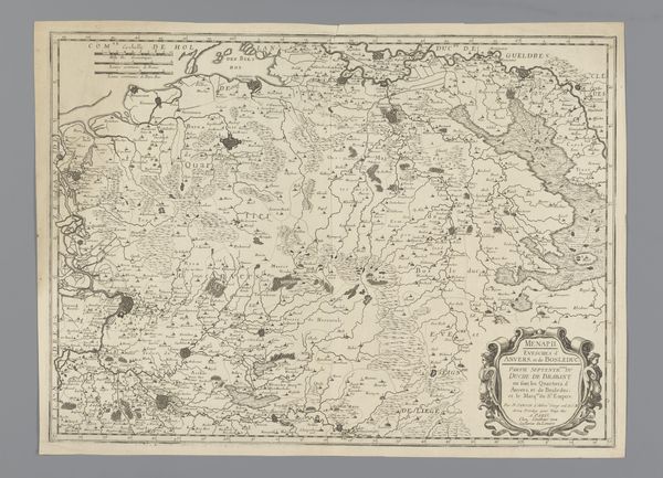
print, engraving
#
baroque
# print
#
landscape
#
engraving
Dimensions: height 386 mm, width 559 mm
Copyright: Rijks Museum: Open Domain
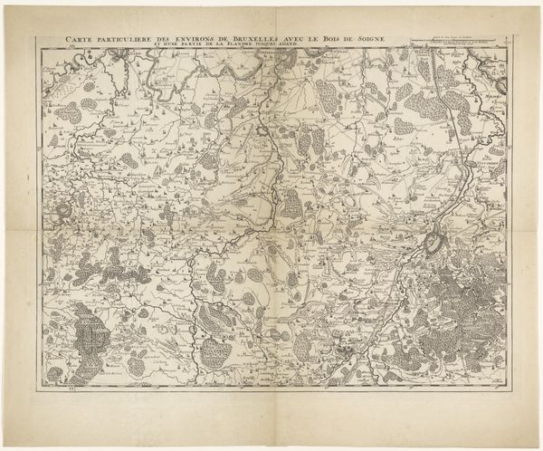
Curator: Let's discuss this captivating 1657 map, "Kaart van het zuidelijk deel van het hertogdom Brabant," an engraving currently held in the Rijksmuseum. It details the southern part of the Duchy of Brabant. Editor: It's a remarkably detailed piece! The density of information is almost overwhelming at first glance. I’m immediately drawn to the quality of the lines; the engraver's skill in capturing so many tiny elements. I wonder about the economic conditions surrounding its production – who commissioned it, who bought it? Curator: Contextually, these maps were commissioned by powerful people, those who sought not only to claim territory but also to visualize their sphere of influence and power within the colonial structure. Consider who the Duchy served; tracing that reveals insights into social and political hierarchy. Editor: Precisely! And thinking about the labour involved – the paper production, the engraver's skill, the distribution network – tells a lot about the socio-economic situation. Each line on this map represents someone’s labor and potentially land divisions leading to unequal land distribution. Curator: Absolutely. Maps also shape our understanding of identity, marking boundaries, differentiating “us” from “them”. Here, it reflects the ongoing political disputes in the Brabant region and acts almost as a form of propaganda of its time. Its ornamental details, the flourishes surrounding the title cartouche, elevate its status beyond simple information; this print has a point of view. Editor: That ornament around the title – I'm interested in its material reproduction; how many impressions were made? What distribution channels were used? We have to wonder how something like this shapes how land itself became a commodity. How was it handled? Curator: Considering that map-making at this time was also considered an art, how can the legacy of colonization be traced? Perhaps there is a relationship to contemporary social injustices that we can see even in our postcolonial landscape. The legacy is ever-present. Editor: Looking at this now, it emphasizes for me that materiality shapes perception and social constructs. From the mines that produced the metals for printing to those owning the information embedded in the image, every part informs how places become concepts and places to conquer, trade or inhabit. It is, in effect, a historical marker. Curator: Ultimately, studying this artwork deepens our knowledge of historical powers, giving context to a deeper and bigger colonial historical narrative. Editor: Agreed, investigating art's materials gives voice to untold truths, urging critical analysis of power structures which otherwise would remain silent.
Comments
No comments
Be the first to comment and join the conversation on the ultimate creative platform.
More like this