print, etching, engraving
#
rippled sketch texture
#
aged paper
#
toned paper
#
light pencil work
#
dutch-golden-age
# print
#
etching
#
pencil sketch
#
old engraving style
#
landscape
#
etching
#
linocut print
#
pen-ink sketch
#
pen work
#
engraving
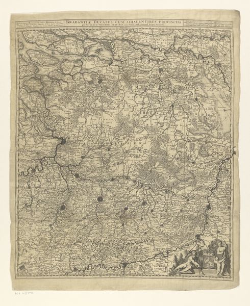
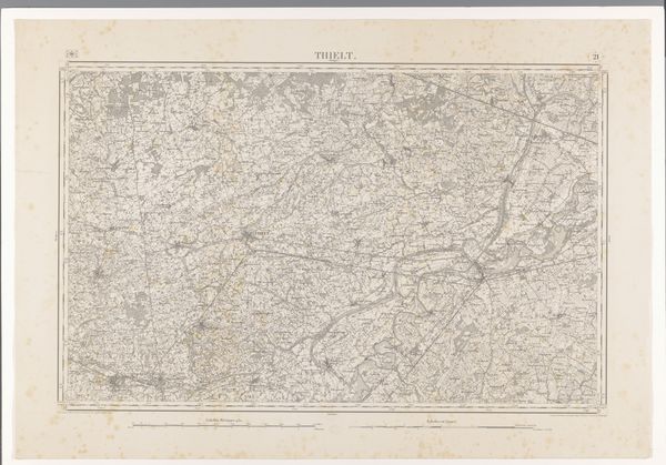
Dimensions: height 473 mm, width 551 mm
Copyright: Rijks Museum: Open Domain
Editor: This etching, “Kaart van het hertogdom Brabant,” or Map of the Duchy of Brabant, from the late 17th century, is incredibly detailed. I’m struck by how this object, a map, embodies so much more than geography; it speaks to power, possession, and perhaps even propaganda. What kind of perspective can you offer? Curator: Well, a map like this is fascinating precisely because it isn’t a neutral representation of space. It reflects a particular vision of the world, or rather, who possesses authority within it. Think about it: creating and distributing a map of this kind was an act of asserting control and knowledge. Who was this map created for, and what purpose did it serve? Was it for military planning, administrative control, or even to impress upon others the extent of Brabant’s territory? Editor: That's a great point. I hadn't really considered the intent behind it. The detail almost legitimizes its claim. It also brings up questions about who gets to define borders, especially given the political climate of the time. How do you see this artwork fitting into the broader socio-political context? Curator: During the 17th century, cartography was undergoing a transformation. The rise of printmaking made maps more accessible, turning them into powerful tools. Brabant was a contested area, caught between various European powers, so depicting its boundaries precisely – even if that precision was subjective – served very specific political ends. This image is therefore enmeshed in the conflicts that were shaping Early Modern Europe, with this beautiful object working to validate and support a desired status quo. What does it make *you* wonder about power structures in play during the Dutch Golden Age? Editor: It really underscores the fact that even seemingly objective depictions can be incredibly loaded with intent and cultural context. The role of visual media is so often embedded in the social structure of a place and time. Curator: Precisely. It allows you to re-contextualize historical power in the present. Maps still play a massive part in geopolitics, wouldn't you agree?
Comments
No comments
Be the first to comment and join the conversation on the ultimate creative platform.
More like this