print, paper, engraving
#
baroque
#
dutch-golden-age
# print
#
landscape
#
paper
#
engraving
Dimensions: height 439 mm, width 573 mm
Copyright: Rijks Museum: Open Domain
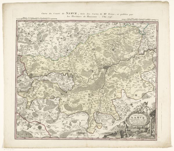
This undated map, made by an anonymous artist, depicts the Spanish and Dutch regions of Flanders. Notice how the composition is dominated by a network of finely etched lines, forming borders, rivers, and settlements, creating a detailed tapestry across the land. The use of colour is restrained, with muted tones defining territories, evoking a sense of historical distance. The map's structure reflects a period of shifting political landscapes, attempting to codify unstable territorial claims through cartographic representation. This act of mapping can be seen through a structuralist lens, as an effort to impose order and meaning on a complex reality, reducing fluid spaces to fixed signs. Consider how the map engages with semiotics, using symbols and inscriptions to communicate power and ownership. The act of defining borders serves not only a practical function but also as a form of cultural coding, asserting control and shaping perceptions of identity. This work prompts us to question the nature of representation and the ways in which maps construct rather than merely reflect reality.
Comments
No comments
Be the first to comment and join the conversation on the ultimate creative platform.
More like this