About this artwork
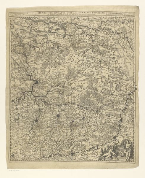
This is an anonymous map of the Duchy of Brabant, whose materiality lies in its engraved lines on paper, now held at the Rijksmuseum. The dominant visual experience is one of intricate detail and texture. The composition is organized through a dense network of lines, which define geographical features and boundaries. This cartographic representation uses a semiotic system where each line and symbol acts as a sign, conveying specific information about the territory it represents. The absence of a traditional artistic signature directs attention to the map's function as a tool for structuring knowledge about space, rather than as an expression of individual creativity. By challenging fixed meanings, this map invites viewers to consider how our understanding of territory is constructed through representation. It is a cultural artifact that continues to provoke questions about how we perceive and define space.
Artwork details
- Medium
- print, etching
- Dimensions
- height 616 mm, width 509 mm
- Location
- Rijksmuseum
- Copyright
- Rijks Museum: Open Domain
Tags
Comments
Share your thoughts
About this artwork
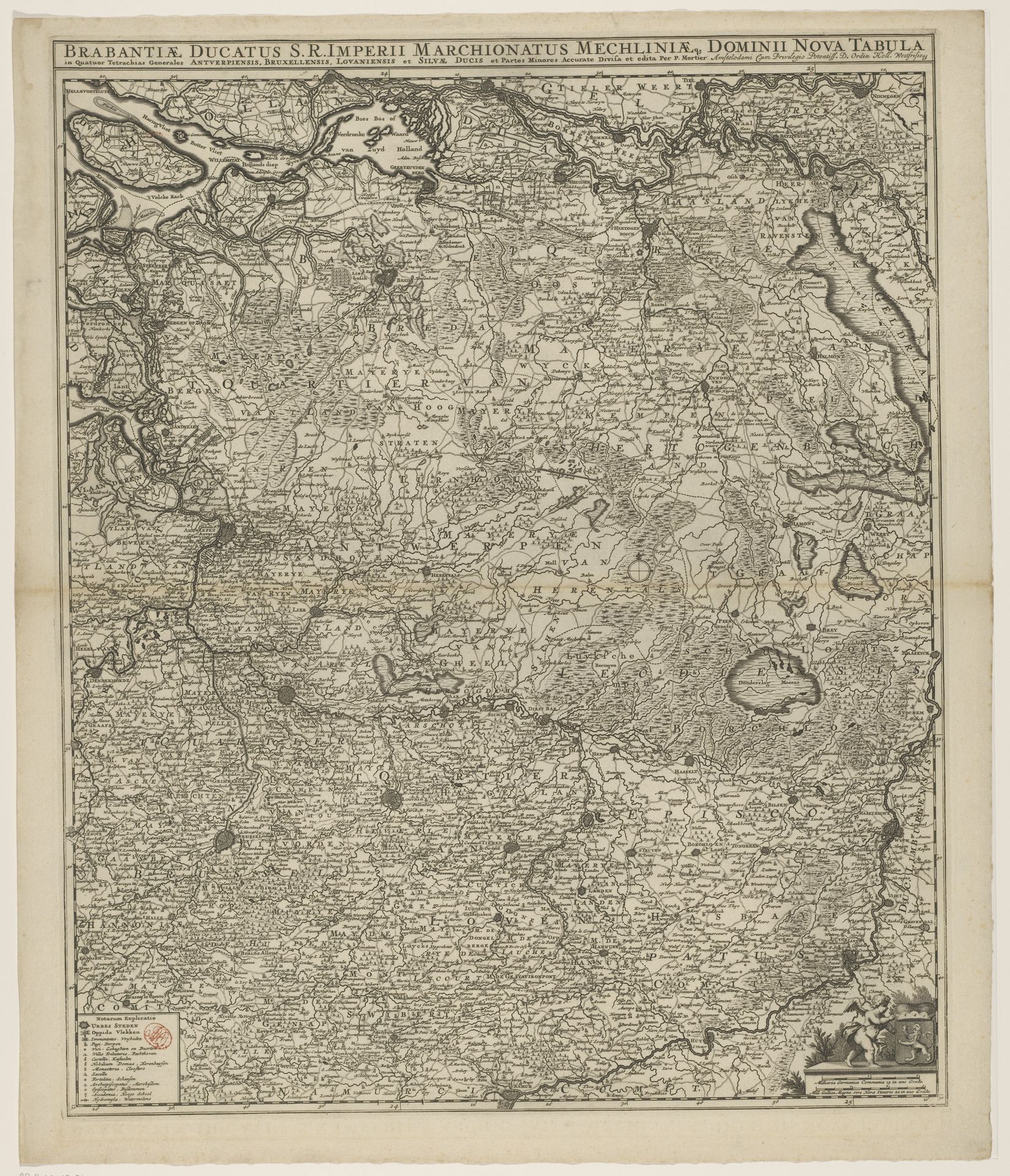
This is an anonymous map of the Duchy of Brabant, whose materiality lies in its engraved lines on paper, now held at the Rijksmuseum. The dominant visual experience is one of intricate detail and texture. The composition is organized through a dense network of lines, which define geographical features and boundaries. This cartographic representation uses a semiotic system where each line and symbol acts as a sign, conveying specific information about the territory it represents. The absence of a traditional artistic signature directs attention to the map's function as a tool for structuring knowledge about space, rather than as an expression of individual creativity. By challenging fixed meanings, this map invites viewers to consider how our understanding of territory is constructed through representation. It is a cultural artifact that continues to provoke questions about how we perceive and define space.
Comments
Share your thoughts