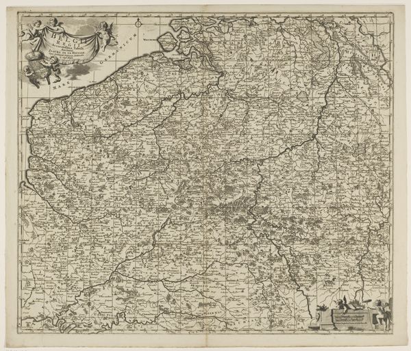
print, engraving
#
baroque
# print
#
old engraving style
#
geometric
#
line
#
engraving
Dimensions: height 513 mm, width 596 mm
Copyright: Rijks Museum: Open Domain
This is Laurens Scherm's map of the County of Namur, created in the late 17th or early 18th century. It’s an engraving, meaning that Scherm used a tool to carve lines into a metal plate, which was then inked and printed onto paper. Consider the labor involved: meticulous drawing skills, a deep knowledge of the region, and the physical effort of engraving. Maps like these weren’t just about geography; they were tools of power. Knowing the landscape – rivers, forests, and towns – was crucial for military strategy and economic control. The very act of mapping was a way of claiming authority over a territory. Think about the social context of this map. It speaks to an age of exploration, colonization, and burgeoning capitalism, where accurate information about resources and trade routes was invaluable. Ultimately, this map is more than just lines on paper; it's a testament to human skill, ambition, and the desire to understand and control the world around us.
Comments
No comments
Be the first to comment and join the conversation on the ultimate creative platform.
More like this