print, engraving
#
baroque
# print
#
old engraving style
#
hand drawn type
#
personal sketchbook
#
ink drawing experimentation
#
geometric
#
cityscape
#
engraving
Dimensions: height 434 mm, width 577 mm
Copyright: Rijks Museum: Open Domain
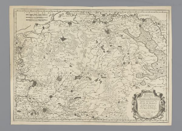
Editor: Here we have Jacobus Harrewijn's "Kaart van het gebied ten westen van Brussel," created between 1708 and 1712, a detailed engraving. It's really striking how the landscape is meticulously laid out, yet it feels more like an artistic rendering than a strictly accurate map. What do you see in this piece? Curator: This map offers a glimpse into the power dynamics of the early 18th century. It's not just a representation of geography, but also a statement of control and ownership. Think about the intended audience—likely wealthy landowners or military strategists. How does the map serve their interests? Editor: I guess it gives them a bird’s eye view of their domains, potentially for strategic planning. Curator: Precisely. Consider the Bois de Soigne—it's prominently featured. What might that forest have represented in terms of resources, hunting rights, or even symbolic power for those who controlled it? Also notice how "Brussels" is at the heart of this mapped-out region. Who benefitted from this type of representation? How is land ownership represented or visualized? Editor: It sounds like this map wasn’t just about wayfinding, it was about visualizing and solidifying power. Do you think the detail is about trying to make this seem scientific? Curator: In a way, yes. The very act of mapping, of imposing order onto a landscape, reflects a certain worldview. It subtly asserts dominance by defining boundaries and resources within a colonial frame. What social narratives are embedded in this bird's-eye perspective? Editor: I see what you mean! I never really considered maps as having their own narratives. It’s about claiming space through art and science combined. Curator: Exactly. By deconstructing these seemingly objective representations, we can uncover the cultural and political values embedded within them. Maps aren't neutral. I'm glad we've come to understand the context and politics behind this cartographic representation together.
Comments
No comments
Be the first to comment and join the conversation on the ultimate creative platform.
More like this