print, etching, engraving
#
baroque
# print
#
etching
#
landscape
#
etching
#
engraving
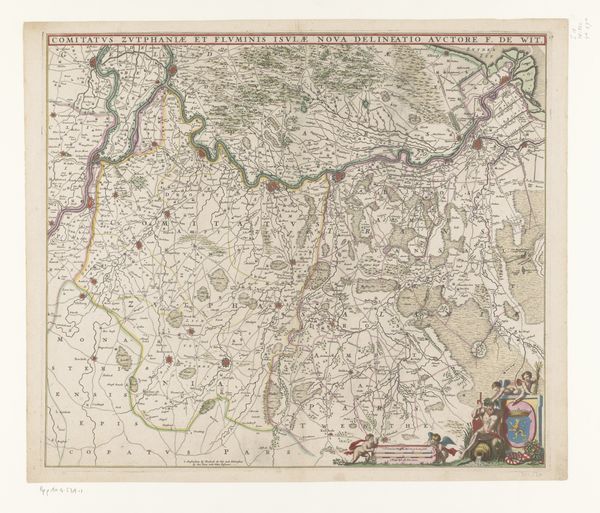
Dimensions: height 205 mm, width 271 mm
Copyright: Rijks Museum: Open Domain
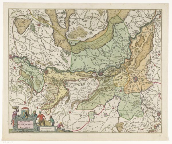
This map of the Austrian Netherlands, was made by Tobias Conrad Lotter sometime in the 1700s. It is rendered through engraving, a printmaking process reliant on the precise and laborious cutting of lines into a metal plate, which is then inked and pressed onto paper. Look closely, and you will see the matrix of tiny engraved lines that create areas of tone and texture. The quality of the lines give the map its distinct aesthetic, and the hand-crafted process imbues it with a sense of artistry. Engraving was more than just a technique; it was a skilled trade. Mapmakers would need to combine geographic knowledge with artistic ability. This piece reflects a culture of exploration, commerce, and scientific advancement. Maps like these were essential tools for trade, navigation, and military strategy. By appreciating the materials, making, and social context of this map, we see how "craft" was essential to the expansion of knowledge and power in the early modern world.
Comments
No comments
Be the first to comment and join the conversation on the ultimate creative platform.
More like this