drawing, print, ink, engraving
#
drawing
#
dutch-golden-age
# print
#
landscape
#
ink
#
geometric
#
pen work
#
natural palette
#
engraving
#
watercolor
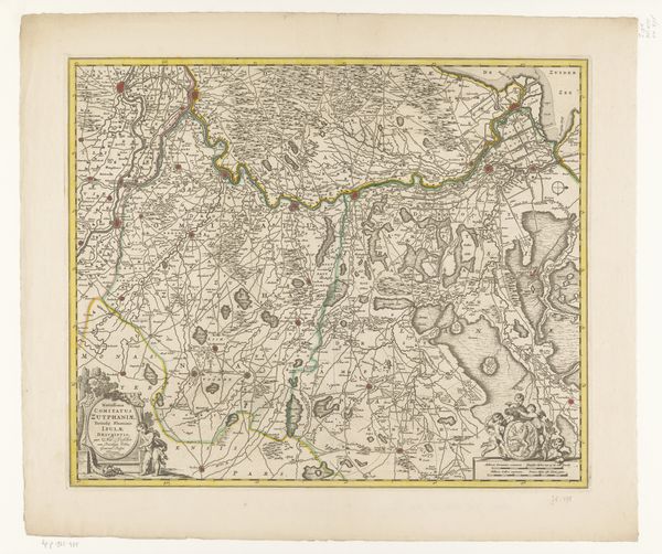
Dimensions: height 493 mm, width 570 mm
Copyright: Rijks Museum: Open Domain
This is an early map of Zutphen, made by an anonymous artist. These maps are more than geographical tools; they are cultural artifacts, reflecting the complex interplay of power, identity, and knowledge during the early modern period. The detailed cartography speaks to the growing importance of geographical knowledge in governance and commerce, but these maps also helped to define territories and identities. Think about how this map might have shaped the self-perception of those living within Zutphen. The act of mapping itself was a political statement, asserting control and understanding over a particular space. Consider also, the stories and histories that are left out. Who was involved in the production of these maps? How did the people living there experience this landscape? While the map provides a bird's eye view of Zutphen, its value lies in prompting us to question how places are represented, by whom, and for what purposes.
Comments
No comments
Be the first to comment and join the conversation on the ultimate creative platform.
More like this