print, engraving
#
aged paper
#
dutch-golden-age
# print
#
landscape
#
linocut print
#
organic pattern
#
natural palette
#
engraving
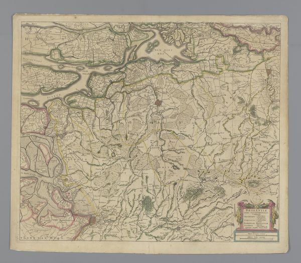
Dimensions: height 470 mm, width 554 mm
Copyright: Rijks Museum: Open Domain
Editor: Here we have a "Kaart van het noordwestelijk deel van Brabant," or "Map of the Northwestern Part of Brabant," dating back to 1633. It's an engraving, currently held at the Rijksmuseum. I'm immediately drawn to its intricate detail. What do you see in this work, particularly regarding its historical context? Curator: This map isn't just a depiction of land; it's a political statement. Consider the context: 1633, during the Eighty Years’ War. Mapping was power. Knowing and controlling the terrain was crucial for military strategy, yes, but also for claiming sovereignty. Who creates a map, for whom is it created, and who is left out? These are vital questions. Editor: So, you're saying the act of creating this map itself was an assertion of control? How does it reflect the power dynamics of the time? Curator: Precisely. Think about the selection of what's included and excluded. Are the settlements named Flemish-speaking or Dutch? Whose interests does this representation serve? Furthermore, cartography, then and now, often silences or misrepresents Indigenous populations. We need to critically examine whose stories are privileged and whose are erased through these seemingly objective representations. Editor: That's fascinating; I hadn't considered the act of mapping as a form of rhetoric. So, it’s about looking beyond the surface-level depiction of geography to understand the social and political motivations embedded within. Curator: Exactly. By understanding the historical and social conditions surrounding the map's creation, we can see how deeply intertwined knowledge, power, and identity truly are. It is our role to keep questioning how representation shapes reality. Editor: This conversation has completely shifted my perspective. I now see maps not just as neutral tools but as complex artifacts reflecting societal power structures. Curator: And that awareness is the first step towards decolonizing our understanding of history.
Comments
No comments
Be the first to comment and join the conversation on the ultimate creative platform.
More like this