drawing, print, paper, ink, engraving
#
drawing
#
dutch-golden-age
# print
#
landscape
#
paper
#
ink
#
engraving
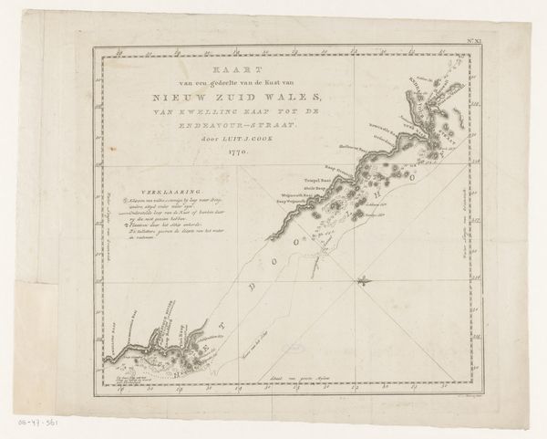
Dimensions: height 374 mm, width 788 mm
Copyright: Rijks Museum: Open Domain
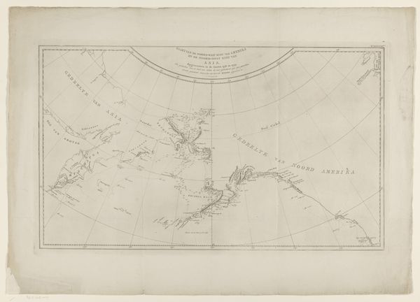
Curator: This artwork, rendered in ink and engraving on paper, is entitled "Kaart van de kust van Nieuw-Zuid-Wales," translating to "Map of the Coast of New South Wales." It's believed to have been created between 1795 and 1809 by Cornelis van Baarsel. Editor: It strikes me as very restrained in its palette. The delicate lines evoke a sense of precision, almost mathematical, and the stark contrast emphasizes its scientific intent. Curator: Precisely. Consider the deliberate choices van Baarsel makes in his cartographic representation. The rigorous lines plotting latitude and longitude emphasize the objective, measured gaze of the explorer. Note also the labels. Editor: Absolutely. From a historical perspective, this isn't merely an objective document. Its creation participates in a colonial project, mapping territory for exploitation and governance. How might this image be interpreted by the indigenous peoples whose lands are being charted? Curator: That is a compelling counterpoint, revealing the politics embedded within supposedly neutral documents. Consider the way van Baarsel utilizes empty space. It creates a certain distancing effect and speaks to what isn’t shown. Editor: And think about who commissioned it and for what purpose? Was it for other sailors? Or to create this colonial administrative understanding of the land for people back in Europe? Curator: It pushes the boundaries of landscape art. The artist prioritizes geographic accuracy while sacrificing representational details. This aligns it more with a scientific record than a picturesque depiction of an unexplored region. The cool palette even furthers this feeling. Editor: Yet it still frames the coast, in a style almost akin to a portrait, the coastline becoming a symbol of dominion rather than just geographic fact. Curator: Analyzing the aesthetic choices, the severe clarity conveys power and technical achievement. Editor: I think you're correct. Reflecting on this engraving, I realize it's not simply about geographical location but about control and interpretation through cartography. Curator: And for me, analyzing how composition becomes its own statement deepens my insight into its semiotic and even structural functions.
Comments
No comments
Be the first to comment and join the conversation on the ultimate creative platform.
More like this