drawing, print, ink, engraving
#
drawing
#
aged paper
#
light pencil work
# print
#
pencil sketch
#
old engraving style
#
hand drawn type
#
landscape
#
personal sketchbook
#
ink
#
ink drawing experimentation
#
geometric
#
pen-ink sketch
#
line
#
sketchbook drawing
#
history-painting
#
sketchbook art
#
engraving
#
realism
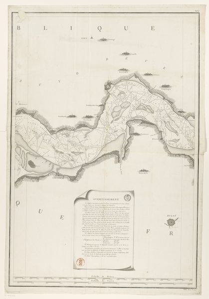
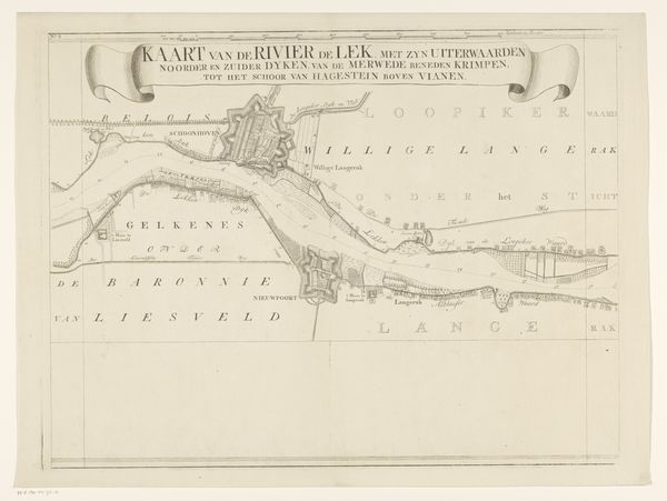
Dimensions: height 954 mm, width 646 mm
Copyright: Rijks Museum: Open Domain
Editor: This is "Kaart van de Westerschelde (eerste deel)," or "Map of the Western Scheldt, first part," made in 1799 by E. Collin. It seems to be a print or engraving, detailing a specific waterway. I'm immediately struck by the detail and precision of the linework; it feels so measured. What stands out to you? Curator: I'm drawn to how this image functions as both a practical tool and a cultural artifact. Maps are powerful symbols, aren't they? They speak of control, of understanding, and of imposing order on the natural world. This map, rendered in the style of an official reconnaissance, served a specific purpose, charting the course of the Scheldt. Yet, what hidden narratives might be embedded within it? What stories of trade, conflict, and cultural exchange are implied by the depiction of this waterway? Editor: I hadn't considered the narrative aspect so directly. I was thinking more about just the lines representing coastlines and water depth. How do we read those implied stories? Curator: Look closer at the details—the presence, or perhaps the *absence*, of certain features, the names given to different locations, the overall impression of control and legibility. Maps such as these served as powerful visual tools, not only for navigation but for solidifying territorial claims. Each stroke carries echoes of past human actions and ambitions. Consider, too, how the style evokes a sense of scientific objectivity that may itself mask particular agendas. Do you see any indication of the cultural and political powers at play through this map? Editor: Now that you mention it, the very deliberate naming, plus the indication of depths… It really feels like a strategic document. Curator: Precisely. And in that strategic intent lies its cultural significance, capturing the spirit and priorities of the age in which it was created. Each choice in representation, consciously or unconsciously, encodes cultural memory. Editor: This makes me look at maps, even modern ones, in a whole new light! They are never neutral.
Comments
No comments
Be the first to comment and join the conversation on the ultimate creative platform.
More like this