print, engraving
#
aged paper
#
parchment
# print
#
old engraving style
#
geometric
#
warm-toned
#
pen work
#
history-painting
#
engraving
Dimensions: height 429 mm, width 346 mm
Copyright: Rijks Museum: Open Domain
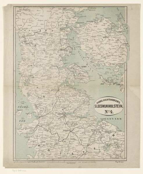
This anonymous map depicts the region of Schleswig-Holstein. Without a specific date, we can still appreciate how maps like this played a crucial role in shaping identity and geopolitical strategy, particularly in contested territories. Historically, this area has been a cultural and political border zone, caught between Danish and German influences, leading to complex questions of belonging and national identity. Maps weren’t just neutral tools; they visually asserted claims to land and resources, influencing how people perceived their place in the world. Consider how the act of mapping itself can be seen as an exercise of power, defining boundaries and often overlooking the lived experiences of those within them. Think about the human stories behind these lines on paper—the communities divided, the struggles for self-determination, and the ongoing negotiation of cultural heritage. What does it mean to see a place reduced to lines and names, and how does this affect our understanding of its history?
Comments
No comments
Be the first to comment and join the conversation on the ultimate creative platform.
More like this