print, engraving
# print
#
landscape
#
geometric
#
engraving
Dimensions: height 482 mm, width 401 mm
Copyright: Rijks Museum: Open Domain
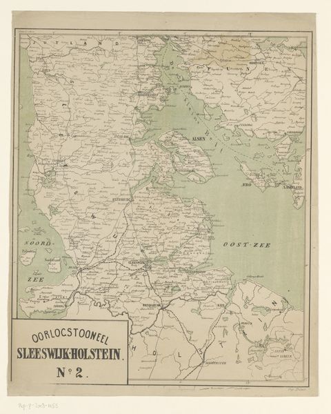
This is an anonymous map of Sleeswijk-Holstein. The area depicted in the map has been a contested region for centuries, caught between the powers of Denmark and Germany. Maps like these became tools of identity, defining and defending national claims. The map reduces complex histories and lived experiences into lines and labels. It represents power dynamics, illustrating who gets to define territories, and whose stories are included or erased. Consider for a moment the act of cartography itself. Who had the authority to survey, name, and claim ownership of the land? What perspectives were privileged in the map-making process, and whose were ignored? This seemingly neutral depiction of land is loaded with political and cultural implications, reflecting and shaping the ongoing struggle for belonging. It invites us to reflect on the stories maps tell, and the stories they leave out.
Comments
No comments
Be the first to comment and join the conversation on the ultimate creative platform.
More like this