About this artwork
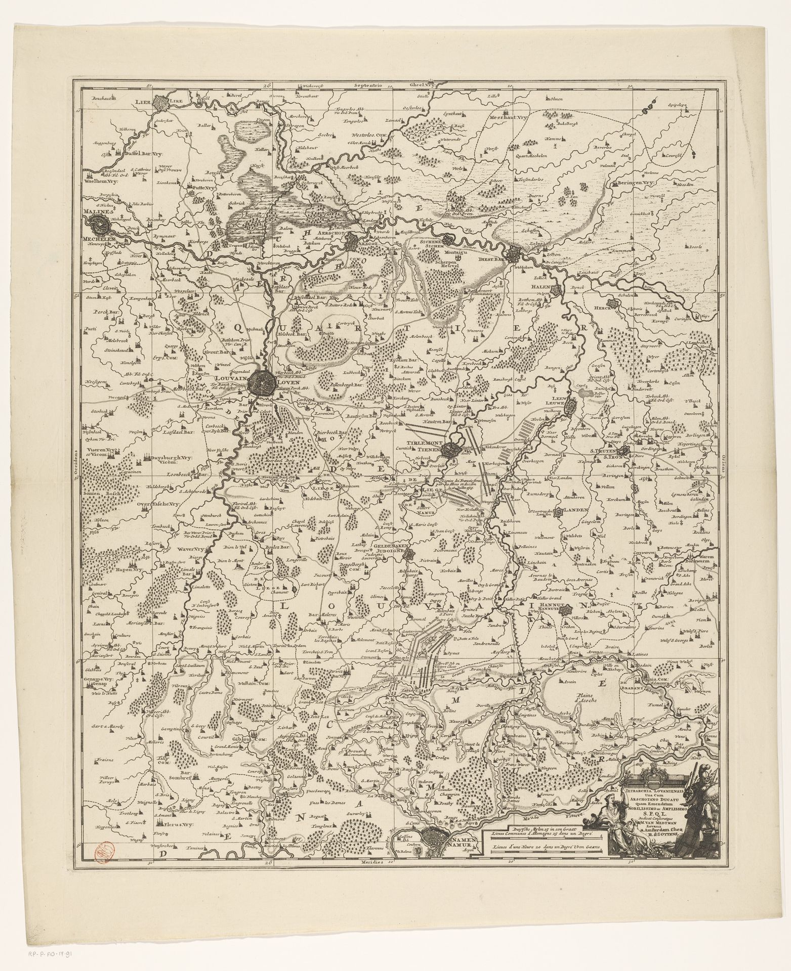
This is an anonymous map of the Leuven quarter, part of the Duchy of Brabant. Executed with meticulous detail, the dense network of lines articulates not just geographical boundaries but also a complex interplay of space and power. Note how the composition organizes itself through a series of enclosures: borders define the area, while rivers and roads act as internal delineators. These lines function as structuring elements that don't merely represent physical realities but impose a kind of visual order. The map becomes a semiotic system, with each symbol and mark acting as a signifier in a larger discourse. The use of scale, too, plays a crucial role. The cartographer invites us to reflect on the relationship between representation and reality, between the lived space and its abstracted depiction. Consider the map as more than just a navigational tool. It operates as a statement about how we perceive and organize the world around us. It's an ongoing dialogue, a conversation that continues to evolve as we reinterpret its lines, shapes, and symbols through the lens of our own experiences.
Kaart van het kwartier van Leuven, onderdeel van het hertogdom Brabant
1726 - 1750
Anonymous
@anonymousLocation
RijksmuseumArtwork details
- Medium
- print, engraving
- Dimensions
- height 579 mm, width 488 mm
- Location
- Rijksmuseum
- Copyright
- Rijks Museum: Open Domain
Tags
baroque
landscape
geometric
engraving
Comments
Be the first to share your thoughts about this work.
About this artwork
This is an anonymous map of the Leuven quarter, part of the Duchy of Brabant. Executed with meticulous detail, the dense network of lines articulates not just geographical boundaries but also a complex interplay of space and power. Note how the composition organizes itself through a series of enclosures: borders define the area, while rivers and roads act as internal delineators. These lines function as structuring elements that don't merely represent physical realities but impose a kind of visual order. The map becomes a semiotic system, with each symbol and mark acting as a signifier in a larger discourse. The use of scale, too, plays a crucial role. The cartographer invites us to reflect on the relationship between representation and reality, between the lived space and its abstracted depiction. Consider the map as more than just a navigational tool. It operates as a statement about how we perceive and organize the world around us. It's an ongoing dialogue, a conversation that continues to evolve as we reinterpret its lines, shapes, and symbols through the lens of our own experiences.
Comments
Be the first to share your thoughts about this work.