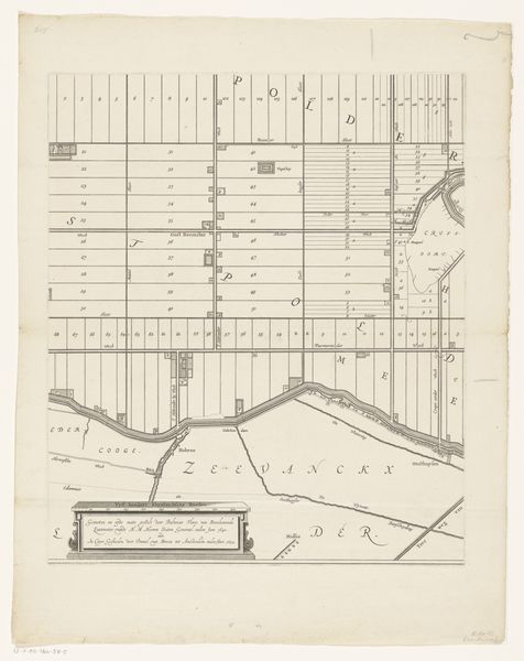
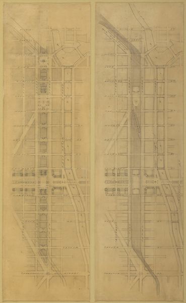
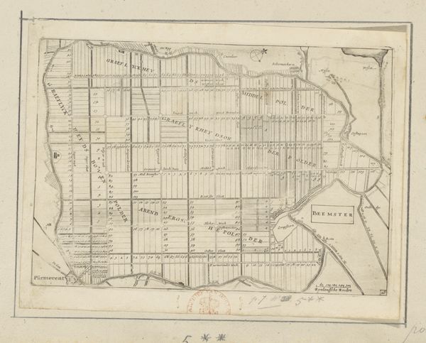
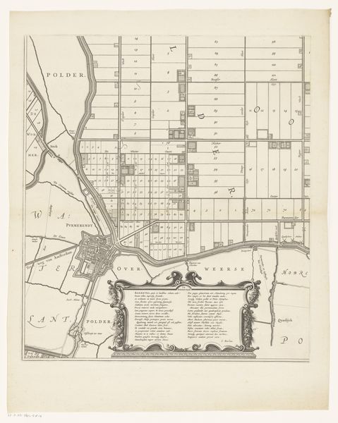
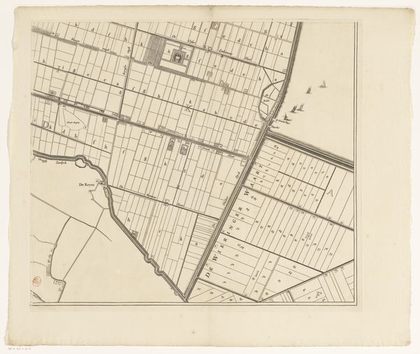
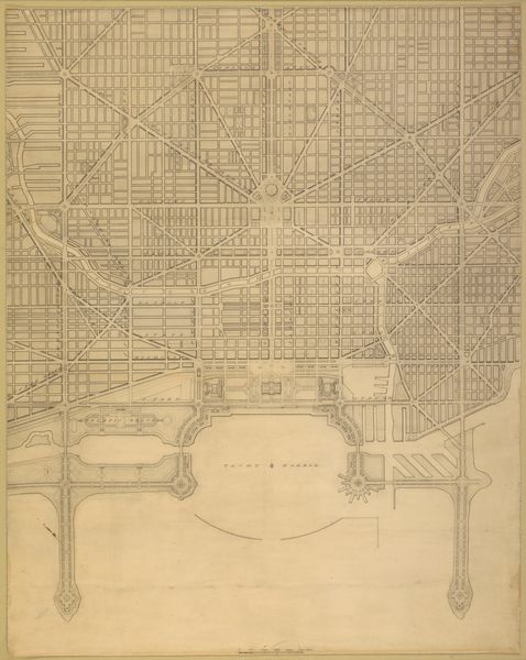
Map of part of the Murray-Hill Estate, Situated in the 12th Ward of the City of New York, to be sold by James Bleecker & Sons on Thursday 11th June 1835, at 12 o'clock, at the Merchant's Exchange 1835
0:00
0:00
drawing, print
#
architectural sketch
#
drawing
#
building study
#
map drawing
# print
#
architectural diagram
#
architectural plan
#
geometric
#
elevation plan
#
architectural section drawing
#
architectural drawing
#
architecture drawing
#
architectural proposal
#
cityscape
Dimensions: Sheet: 23 1/16 × 18 11/16 in. (58.5 × 47.5 cm)
Copyright: Public Domain
Curator: Looking at this, my first thought is just how ordered everything appears. A grid, promising a clean, manageable future. Is it naive to see optimism here? Editor: Perhaps, but such cartographic projections often belie the social complexities they encode. What we're viewing is "Map of part of the Murray-Hill Estate," dating to 1835, printed to promote a land auction. Note how avenues and streets are crisply demarcated, carving up the landscape. This isn't just a neutral layout. Curator: Right, it’s a sales pitch. A paper dream, laid out with almost mathematical precision, promising property and prosperity. You can almost feel the aspirations baked into the ink. Editor: Indeed. Land ownership in this era was inextricably linked to power, and to specific demographic groups. These plotted lines not only represent potential wealth, but also implicate narratives of class and exclusion. Who could afford to buy a plot in 1835, and who was displaced in this pursuit of expansion? Curator: It makes you wonder about the human stories paved over in the process. A feeling both compelling and faintly melancholic when I ponder over them. The past whispers if we really listen. Editor: Absolutely. Also, remember that Murray Hill, at this point, was envisioned as an exclusive residential area, reflecting broader social stratification in New York. The map isn’t just about selling land, it's about selling a lifestyle. Curator: So, looking at the architecture drawing, these neatly arranged lots are less about open possibilities and more about solidifying certain hierarchies. That puts a different spin on the geometry, doesn’t it? Editor: Precisely. What appears as order and planning on the surface is undergirded by dynamics of power and control. Even something as seemingly simple as a map serves as a tool for shaping not just the urban landscape, but the social one as well. Curator: Maps aren't mirrors. Editor: They are statements, promises, arguments cast on paper. Curator: Knowing the forces behind this neat arrangement gives you so much more to ponder when strolling through Murray Hill today. The present is never really only the present, is it? Editor: It’s a layered text we are always interpreting and re-interpreting, just as maps transform from planning tools to historical palimpsests.
Comments
No comments
Be the first to comment and join the conversation on the ultimate creative platform.
More like this