drawing, lithograph, print, paper
drawing
dutch-golden-age
lithograph
paper
romanticism
cityscape
Dimensions: height 410 mm, width 524 mm
Copyright: Rijks Museum: Open Domain
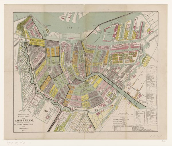
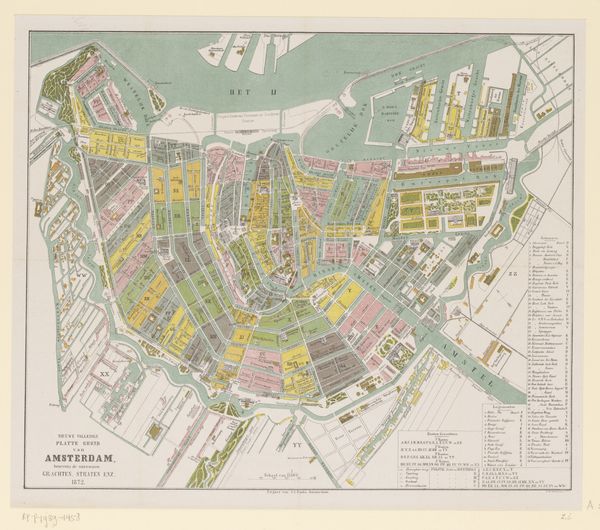
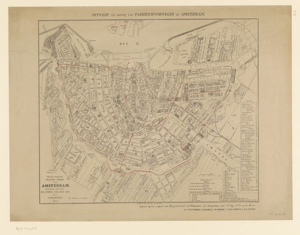
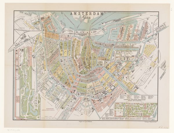
Curator: I’m struck by the tenderness in this map, this "Plattegrond van Amsterdam" from 1837-1839, created by Daniël (II) Veelwaard. It’s so meticulously rendered as a print. You can practically smell the canals, can’t you? Editor: Absolutely, it’s charming. It feels almost… friendly, for a city plan. Not sterile or clinical. I like the romantic wash of colors, dividing Amsterdam into distinct districts. What was the impulse for making it this way, and what’s its significance, placed within a collection? Curator: I find this plan so interesting, precisely because it humanizes the city. During the early 19th century, Amsterdam was grappling with significant changes and this work presents the city to its citizens in a way that feels accessible, legible. Veelwaard uses color coding, labeling different quarters as if they're old friends to be remembered and celebrated. Editor: I notice a strange mix of exactitude and emotion in it, too. Those precise lines suggest the Enlightenment, yet those soft, almost pastel hues… and all the empty spaces that speak about open opportunities on this harbor tell an opposing tale. Like the beginning of mass printing gave ordinary folk a chance to buy property. Curator: Exactly! Mass-produced city plans became vital in the Netherlands. This wasn't just a map; it was a statement about ownership, progress and place, which could appeal to a wide audience and fuel urban and rural speculation about rising market opportunities. Editor: Thinking about who engaged with these items at home or work also excites me. It's very satisfying. Seeing where people place themselves as parts of larger processes; Veelwaard seemed to capture it perfectly for Amsterdam at that moment! Curator: I completely agree. There is something deeply resonant about this representation, offering its viewers, from nearly two centuries on, not just geography, yet a sense of ownership over a changing metropolis. Editor: A wonderful convergence of the rational and the romantic indeed! This feels special and really speaks volumes to what has passed!
Comments
No comments
Be the first to comment and join the conversation on the ultimate creative platform.