About this artwork
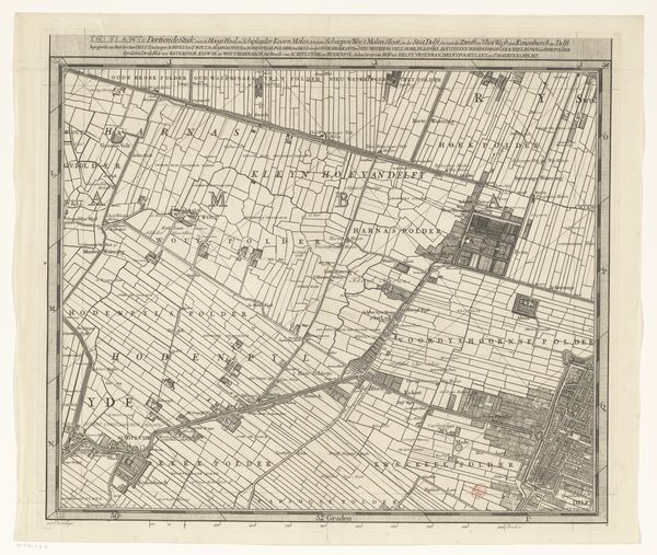
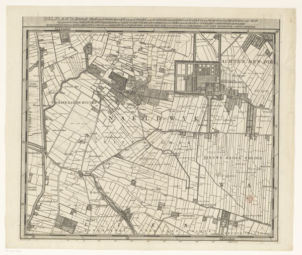
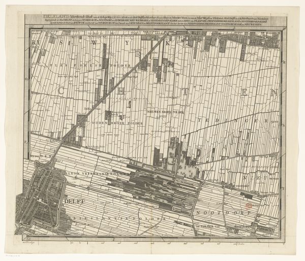
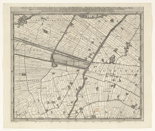
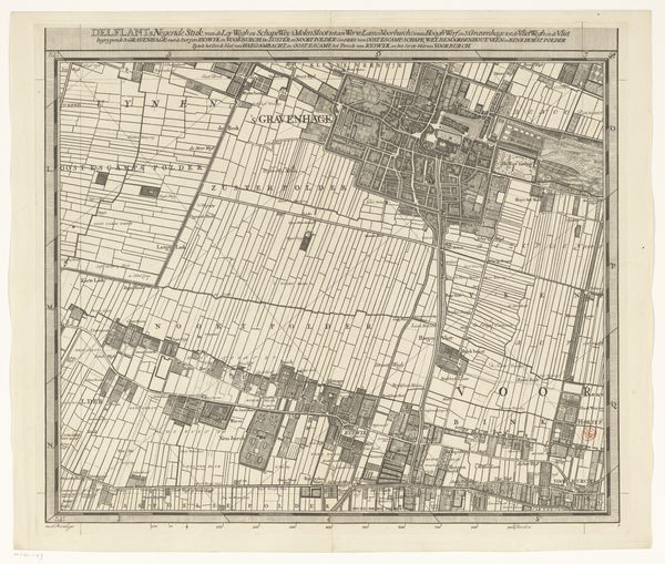
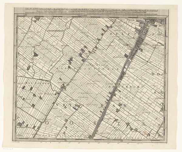
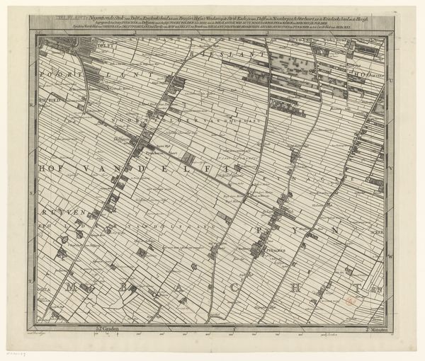
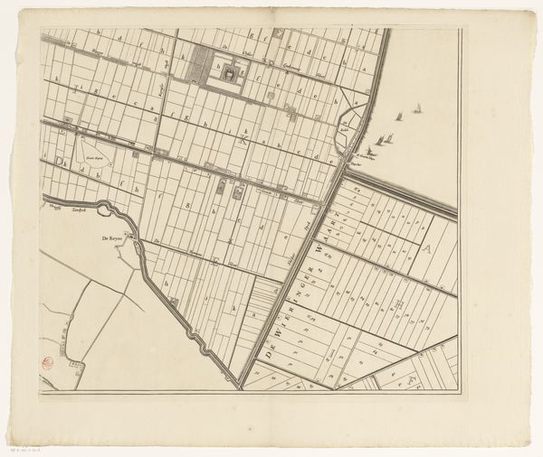
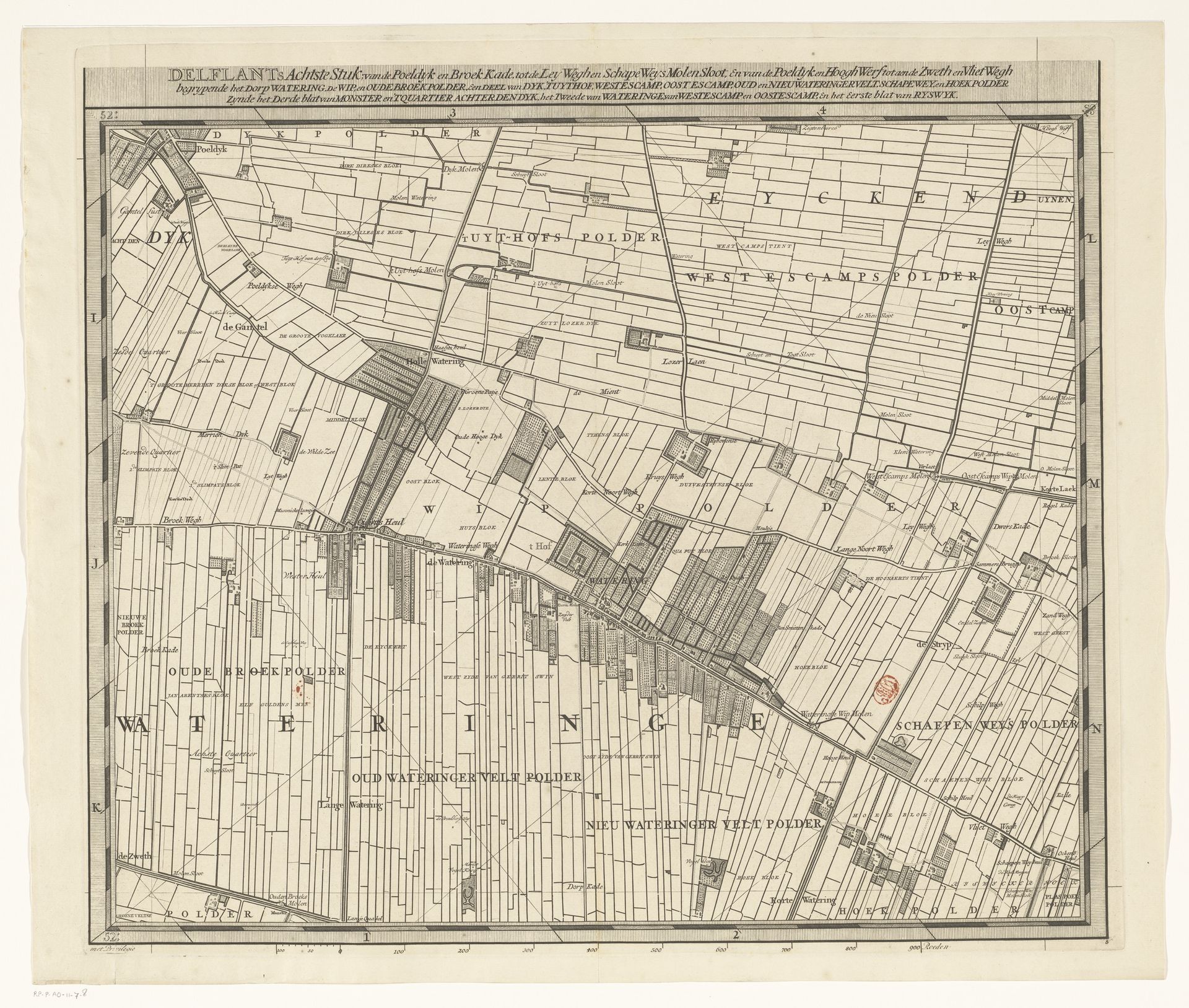
Curator: Luggert van Anse, it seems, gifted us this intricate bird's-eye view, "Kaart van het Hoogheemraadschap van Delfland (achtste deel)," somewhere between 1712 and 1735. The copperplate engraving unfolds as the eighth section of a larger map, meticulously charting the Delfland water board area. Editor: My first thought is how beautifully obsessive it is. It’s like the artist wanted to capture every blade of grass and meticulously control every drop of water. All those tiny lines – a real dedication to detail, which kind of makes me think of Borges’s story about the map that was the size of the empire. Curator: Indeed, its beauty belies its functional purpose. Consider the sociopolitical backdrop. These polders, reclaimed from the sea, demanded precise management, and maps like this weren't just picturesque representations but vital tools for governance, water management, taxation, land disputes – the lifeblood of the Dutch Republic's economic engine. Editor: The precision does take me out of the landscape, though. I wonder if those living and toiling in those fields felt more a sense of being part of nature or of controlling it, being dominated *by* its need to be charted? It's not Romantic, that's for sure. There's not much room for, like, a sunset or a windmill in your hair here. Curator: Precisely. The 'Dutch Golden Age' involved intense landscape engineering. This engraving, with its geometric shapes and precise delineations, underscores this tension. Nature transformed into a commodity through cartographic precision. The artist serves as both recorder and enforcer of societal order. Editor: Right, right... still, I can’t help but zoom into those little squares and lines, though, and invent stories for each farmer, imagining his little cottage over there... Even something as precise as this can be a vessel for daydreaming if you just allow yourself that opening. It reminds me a little of the overview effect... the shock of seeing something huge like Earth rendered into something small... It kind of gives us license to play and imagine what it all *means.* Curator: An interesting thought! While my mind defaults to civic order, administrative apparatuses, and property ownership when faced with maps such as this one... yours seems to gravitate towards narrative, towards life blossoming in the cracks between representation. I'll consider this. Thank you. Editor: Anytime! All these stories hidden behind every line, huh? Pretty powerful.
Kaart van het Hoogheemraadschap van Delfland (achtste deel) 1712 - 1735
Artwork details
- Medium
- drawing, print, engraving
- Dimensions
- height 520 mm, width 591 mm
- Copyright
- Rijks Museum: Open Domain
Tags
drawing
dutch-golden-age
landscape
geometric
engraving
Comments
No comments
About this artwork
Curator: Luggert van Anse, it seems, gifted us this intricate bird's-eye view, "Kaart van het Hoogheemraadschap van Delfland (achtste deel)," somewhere between 1712 and 1735. The copperplate engraving unfolds as the eighth section of a larger map, meticulously charting the Delfland water board area. Editor: My first thought is how beautifully obsessive it is. It’s like the artist wanted to capture every blade of grass and meticulously control every drop of water. All those tiny lines – a real dedication to detail, which kind of makes me think of Borges’s story about the map that was the size of the empire. Curator: Indeed, its beauty belies its functional purpose. Consider the sociopolitical backdrop. These polders, reclaimed from the sea, demanded precise management, and maps like this weren't just picturesque representations but vital tools for governance, water management, taxation, land disputes – the lifeblood of the Dutch Republic's economic engine. Editor: The precision does take me out of the landscape, though. I wonder if those living and toiling in those fields felt more a sense of being part of nature or of controlling it, being dominated *by* its need to be charted? It's not Romantic, that's for sure. There's not much room for, like, a sunset or a windmill in your hair here. Curator: Precisely. The 'Dutch Golden Age' involved intense landscape engineering. This engraving, with its geometric shapes and precise delineations, underscores this tension. Nature transformed into a commodity through cartographic precision. The artist serves as both recorder and enforcer of societal order. Editor: Right, right... still, I can’t help but zoom into those little squares and lines, though, and invent stories for each farmer, imagining his little cottage over there... Even something as precise as this can be a vessel for daydreaming if you just allow yourself that opening. It reminds me a little of the overview effect... the shock of seeing something huge like Earth rendered into something small... It kind of gives us license to play and imagine what it all *means.* Curator: An interesting thought! While my mind defaults to civic order, administrative apparatuses, and property ownership when faced with maps such as this one... yours seems to gravitate towards narrative, towards life blossoming in the cracks between representation. I'll consider this. Thank you. Editor: Anytime! All these stories hidden behind every line, huh? Pretty powerful.
Comments
No comments