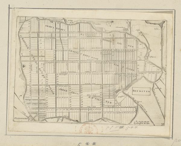
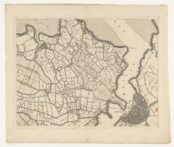
Kaart van de Zijpe- en Hazepolder (deel rechtsonder) 1665 - 1760
0:00
0:00
reiniervanpersijn
Rijksmuseum
print, etching
#
dutch-golden-age
# print
#
etching
#
landscape
#
etching
Dimensions: height 480 mm, width 545 mm
Copyright: Rijks Museum: Open Domain
Editor: Here we have a fascinating object: a map titled "Kaart van de Zijpe- en Hazepolder," specifically the lower right section. It's an etching dating sometime between 1665 and 1760, attributed to Reinier van Persijn. The detail is remarkable; you can almost trace the waterways. How would you approach analyzing this piece? Curator: Well, as a materialist, I'm drawn to the map's function within its society. This isn't just a pretty picture; it’s a document of land ownership and resource management. Look at the grid system—how does this reflect the Dutch emphasis on controlling and exploiting their landscape through polders? Consider also the labour required to produce both the map and the mapped landscape, from the physical process of etching to the infrastructural transformations on the ground. Editor: So, you're seeing the map as a tool related to labour and resource control? Curator: Precisely. The very act of creating such a detailed map involved specific technologies and expertise that were unevenly distributed in society. Who owned these lands? How did the detailed mapping facilitate that ownership, enabling more effective resource extraction and solidifying power structures? Who labored, who profited? What materials were used, and where did they come from? The availability of those materials impacts the final work. Editor: That makes me consider it in a whole new light, beyond just aesthetic appreciation of the detailed etching technique. I am now curious how the rise of mercantilism influenced cartography. Curator: Exactly! Seeing art as intrinsically linked to broader socio-economic structures reveals otherwise unseen layers of meaning and opens a path to ask other important questions. Editor: Thanks; it's like the map is showing a cross-section, not just of the land, but of Dutch society.
Comments
No comments
Be the first to comment and join the conversation on the ultimate creative platform.
More like this