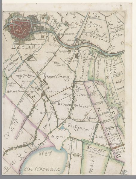
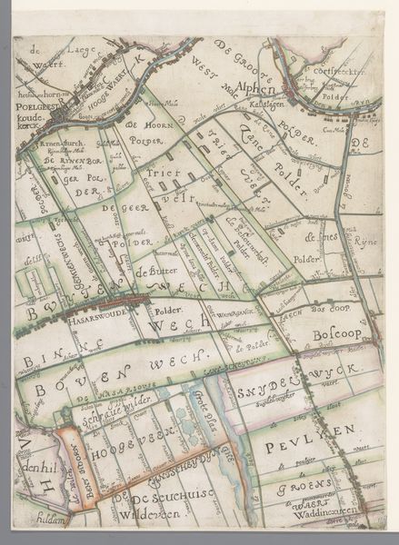
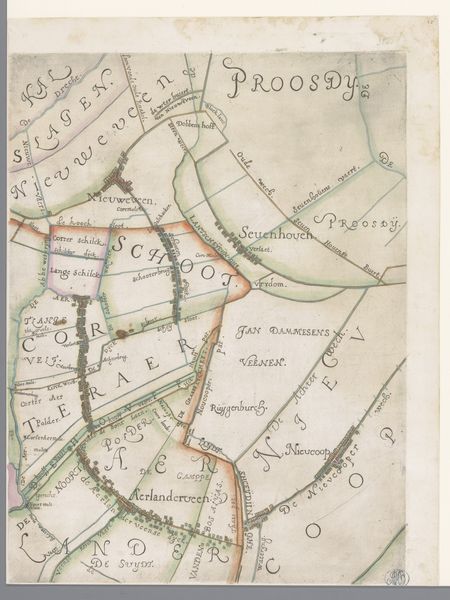
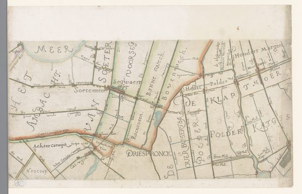
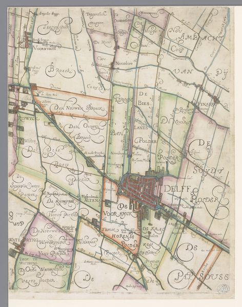
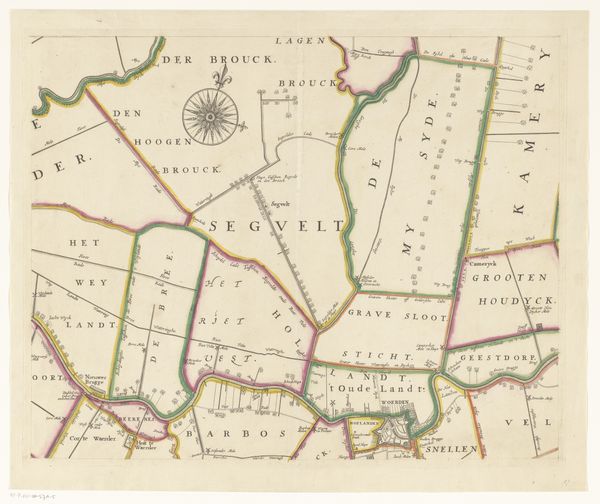
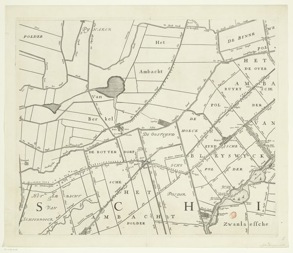
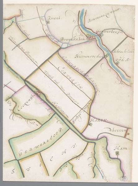
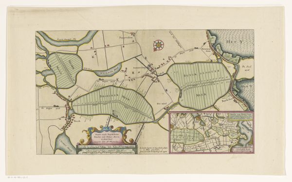
Deel van een kaart van het Hoogheemraadschap van Rijnland, met Bodegraven en omgeving 1615
florisbalthasarszvanberckenrode
Rijksmuseum
drawing, paper, watercolor, ink
drawing
map drawing
dutch-golden-age
landscape
paper
watercolor
ink
geometric
regionalism
Dimensions: height 364 mm, width 276 mm
Copyright: Rijks Museum: Open Domain
Curator: This intricate map, created around 1615 by Floris Balthasarsz van Berckenrode, offers a glimpse into the Rijnland region of the Netherlands. Editor: My first impression is one of order and control. Look at the precise lines, the neat divisions of space. It speaks to a society deeply engaged in managing its environment, probably farmland. Curator: Absolutely. Consider the materials: ink and watercolor on paper. The paper itself, its source, represents industry, trade and likely stems from rags painstakingly recycled into a usable surface. Editor: I'm drawn to the use of color, particularly the pink and green hues. What do they represent to you, and were these common colours for these older maps? Curator: Well, these colors were likely chosen to differentiate between various land parcels and perhaps denote ownership or land use. They create a visual system of organization, assisting navigation and legal delineation within this watery world. The colours would derive from available pigment technology and speak to material and financial investment in land surveying. Editor: Ah, yes. It all reinforces the human imprint on this land. I also find these little house symbols quite compelling. Each is similar to the next and represents home and security. Curator: They point us towards the everyday lives and work performed by individuals and communities who managed these landscapes. Look closer at the shapes and lines, geometric but always defined and produced through human labor, creating this image of control over landscape. Editor: The work is filled with layers of information that echo not only where things were, but hint to us about who the stakeholders in these properties were, a society investing in defining space, building society as they built homes and farms. Curator: Agreed. It serves as a fascinating object study, a symbol of material agency and Dutch ingenuity when dealing with waterlogged landscapes and colonial trade and production, all visible through the material components. Editor: This careful combination of geographic specificity and iconic representations reminds us of our ongoing quest to map not just the world, but our place within it, while creating and managing resources from land around us.
Comments
No comments
Be the first to comment and join the conversation on the ultimate creative platform.