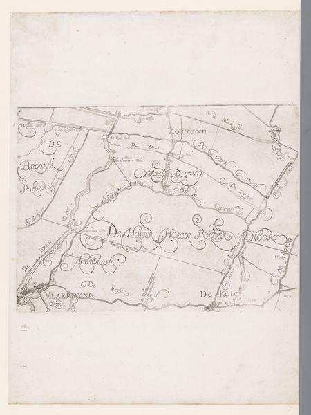
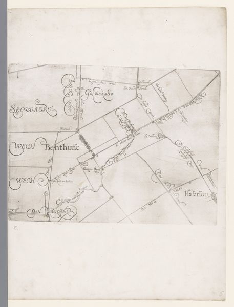
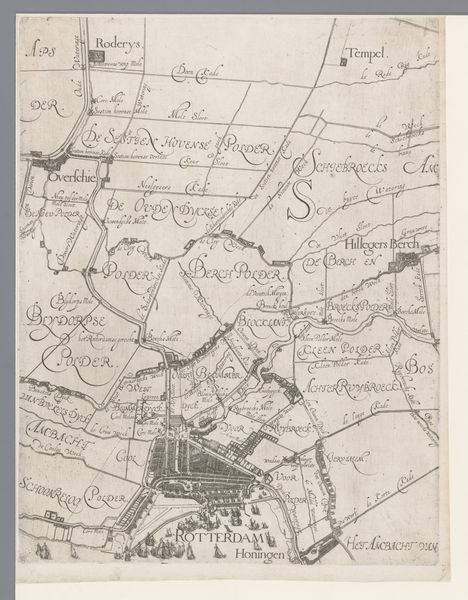
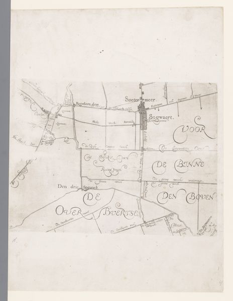
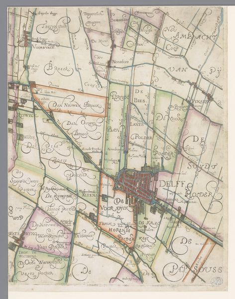
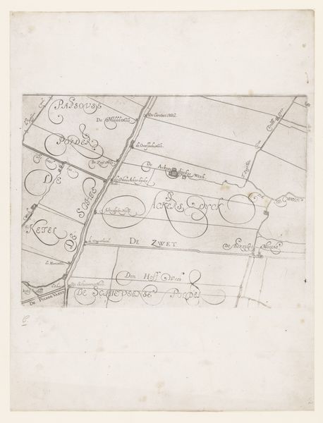
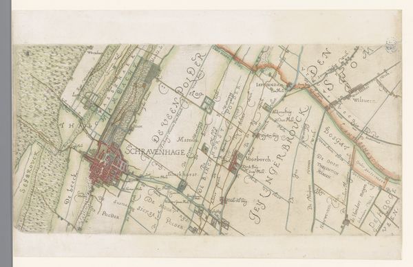
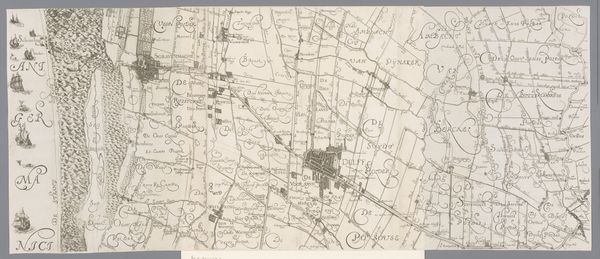
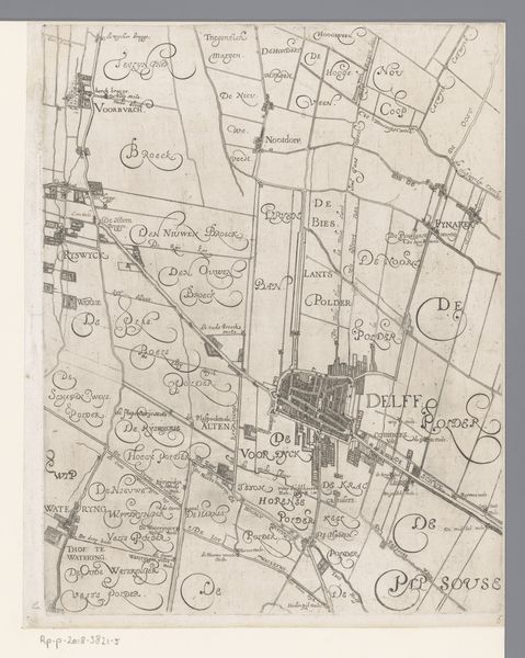
Kaart van het Hoogheemraadschap van Delfland, met Zevenhuizen en Bleiswijk, deel rechtsboven 1611 - 1692
florisbalthasarszvanberckenrode
Rijksmuseum
drawing, paper, ink
drawing
dutch-golden-age
landscape
paper
ink
geometric
Dimensions: height 239 mm, width 238 mm
Copyright: Rijks Museum: Open Domain
Curator: Look at this intriguing drawing. It’s a portion of "Kaart van het Hoogheemraadschap van Delfland, met Zevenhuizen en Bleiswijk," a map of the Delfland region created between 1611 and 1692, by Floris Balthasarsz van Berckenrode. Editor: It’s quite striking how geometric the landscape appears. So much imposed order. Almost feels…clinical, even. Curator: Maps like these weren't just about geographical accuracy; they represented power structures. Consider the meticulous labor involved in surveying and drafting, skills primarily accessed by privileged members of Dutch society. This level of detail signifies control over land and resources. Editor: Absolutely. The very act of mapping is an act of claiming, organizing the natural world to reflect human needs. We should think about the social context – land ownership, water management – and who benefited from these mapped-out divisions during that time period. These neat divisions hide the intense contestations and power dynamics inherent in controlling water resources, a particularly crucial issue in the Low Countries. Curator: The choice of ink and paper also informs our understanding. These materials speak to the availability and cost of documentation at the time. And the artistic flourishes of the script elevate the document beyond a mere functional diagram. This isn't just cartography; it’s craftsmanship. Editor: Precisely. The elegant script you mentioned isn’t simply decorative, it also signifies a certain level of literacy and education, pointing to the socioeconomic status of those who produced and consumed this kind of visual material. Curator: The map gives a detailed snapshot into the water management systems and engineering marvels achieved in that area. Canals, locks…all testament to their ability to shape the environment. Editor: Right, and how that impacts notions of space, access, and community is still worth questioning now. Maps aren't neutral documents; they can uphold certain values and make some histories far more visible than others. Curator: I'll certainly view this artwork with a more questioning eye moving forward. Editor: Me too. Examining this map has underscored just how deeply art is intertwined with historical and social power.
Comments
No comments
Be the first to comment and join the conversation on the ultimate creative platform.