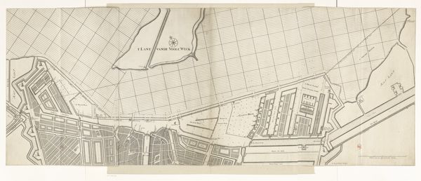
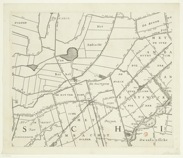
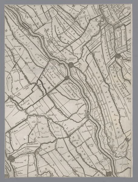
Kaart van het Hoogheemraadschap van de Krimpenerwaard (derde deel van kaart) 1683 - 1755
0:00
0:00
johannesleupenius
Rijksmuseum
drawing, print, etching, ink
#
architectural sketch
#
drawing
#
dutch-golden-age
# print
#
etching
#
old engraving style
#
landscape
#
etching
#
linework heavy
#
ink
#
pen-ink sketch
#
thin linework
#
architectural drawing
#
pen work
#
architecture drawing
#
storyboard and sketchbook work
Dimensions: height 431 mm, width 522 mm
Copyright: Rijks Museum: Open Domain
This is the third section of a map of the Krimpenerwaard region, created by Johannes Leupenius in the late 17th century. It's an etching, a printmaking process where lines are incised into a metal plate with acid, then inked and pressed onto paper. This technique was crucial for disseminating knowledge and shaping perceptions of territory during the Dutch Golden Age. The sharp, precise lines weren't just about accuracy; they represented control and a burgeoning sense of mastery over the land. Notice how the waterways and polders are carefully delineated. This wasn't just art, it was a tool for governance and resource management. The very act of mapping, and therefore owning a territory, becomes a mark of authority. The labor of etching, the skill required for this technique, speaks to the societal values placed on precision and order. What began as craft, became an important medium of political power and consumption.
Comments
No comments
Be the first to comment and join the conversation on the ultimate creative platform.
More like this