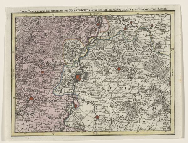
print, engraving
#
baroque
# print
#
landscape
#
engraving
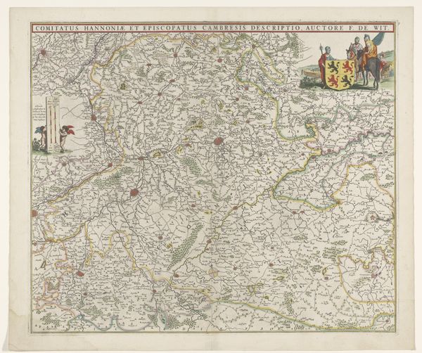
Dimensions: height 528 mm, width 735 mm
Copyright: Rijks Museum: Open Domain
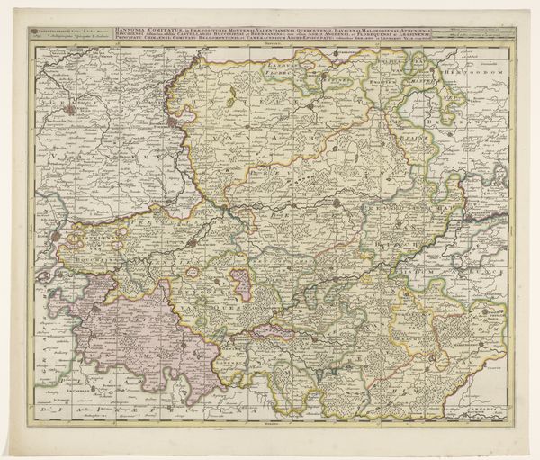
Curator: Up next, we have an intriguing piece titled "Kaart van het graafschap Henegouwen," or "Map of the County of Hainaut," dating back to 1691. It's a meticulously detailed engraving, a print made by an anonymous artist, and it's currently part of the Rijksmuseum's collection. Editor: Immediately, I'm struck by its intricacy! It’s more than just lines on a page; it feels like an entire world compressed. There's a density of detail here that invites a long, thoughtful gaze, almost like diving into an ancient text. Curator: Indeed. What appears at first glance as simply geographical is laden with symbolic meaning. These maps served multiple purposes; they documented territories but also projected power and affirmed ownership. Think about the symbolism inherent in charting and naming every village and forest, the implication being that knowing it is akin to possessing it. Editor: Absolutely. And it's all rendered in this exquisitely delicate Baroque style! I see the flourishes, the decorative cartouche at the top with the heraldic symbols... these aren't just practical documents. They speak volumes about the period's aesthetic values. Look at how nature is depicted – these little stylized trees and hills aren’t quite photorealistic. There's an idealized element there too, right? Curator: Spot on! The map isn't just mirroring reality, it’s interpreting it, showcasing its owner in the best possible light. And that touches upon how these maps played a role in cultural memory – fixing a territory's image within a very specific political moment. This specific map presents a view of what is now Belgium from what was likely intended to underscore regional prominence. Editor: Looking at it now, the density almost becomes hypnotic. It pulls you in, this micro-world. You start imagining the people who lived in all those tiny places, following those thin, winding roads… I find a bit of melancholic beauty in it all – reminders of empires long changed. Curator: It’s fascinating how such detailed historical documents also provide us with a window into human ambition, artistic expression, and the enduring drive to chart our place in the world, both literally and figuratively. Editor: I completely agree. It makes me think about the stories we inscribe upon our landscapes, then and now. I imagine looking at modern maps and contemplating what they will say of our time to people hundreds of years in the future.
Comments
No comments
Be the first to comment and join the conversation on the ultimate creative platform.
More like this