#
aged paper
#
homemade paper
#
paper non-digital material
#
sketch book
#
personal sketchbook
#
sketchbook drawing
#
watercolour bleed
#
sketchbook art
#
design on paper
#
watercolor
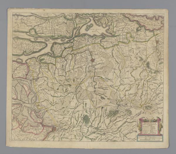
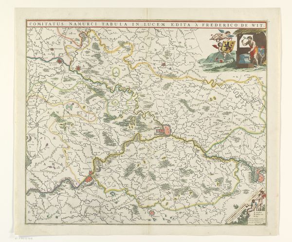
Dimensions: height 463 mm, width 550 mm
Copyright: Rijks Museum: Open Domain
This is an anonymous map of the southern part of the Duchy of Brabant. Its purpose was to show the region's towns, roads, and waterways. Maps are never neutral; they are imbued with political meaning, defining territories and establishing borders. This map reflects the complex geopolitics of the 17th century, a period marked by the rise of nation-states and intensifying colonial competition. Brabant, located at the crossroads of Europe, was a contested territory between the Dutch Republic and the Spanish Netherlands. Mapping it was an assertion of ownership and control. The map would have been used by merchants, soldiers, and administrators, and would have had a role in shaping their perceptions of the region. Historians consult archives, treaties, and other visual sources to better understand the production and reception of maps like this one. By situating this map in its historical context, we can better appreciate its role in shaping the social and political landscape of early modern Europe.
Comments
No comments
Be the first to comment and join the conversation on the ultimate creative platform.
More like this