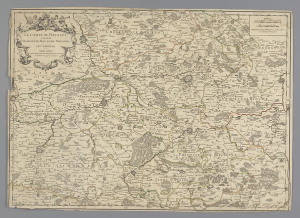
Kaart van het graafschap Henegouwen en het aartsbisdom Kamerijk 1666 - 1670
0:00
0:00
anonymous
Rijksmuseum
drawing, print, paper, ink, engraving
#
drawing
#
baroque
# print
#
landscape
#
paper
#
ink
#
cityscape
#
engraving
#
watercolor
Dimensions: height 473 mm, width 555 mm
Copyright: Rijks Museum: Open Domain
This is an anonymous map of the County of Hainaut and the Archdiocese of Cambrai. The map offers a dense tapestry of lines, shapes, and colours. A network of fine lines traces the rivers and roads, crisscrossing the landscape. The various towns and villages appear as clusters of tiny buildings. The visual weight of the map is distributed evenly, creating a balanced composition. Cartography has always been about power and knowledge. Here, the act of mapping is an act of claiming. Each line drawn, each boundary marked, asserts a certain level of control over the territory it represents. The map creates its own reality, shaping how we perceive and understand the space. Ultimately, this map is not just a static document. It is an active participant in the ongoing cultural and philosophical discourse of its time. It invites us to question the nature of representation, the construction of knowledge, and the power dynamics inherent in the act of mapping itself.
Comments
No comments
Be the first to comment and join the conversation on the ultimate creative platform.
More like this