print, etching, engraving
#
baroque
# print
#
etching
#
old engraving style
#
line
#
history-painting
#
engraving
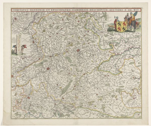
Dimensions: height 440 mm, width 580 mm
Copyright: Rijks Museum: Open Domain
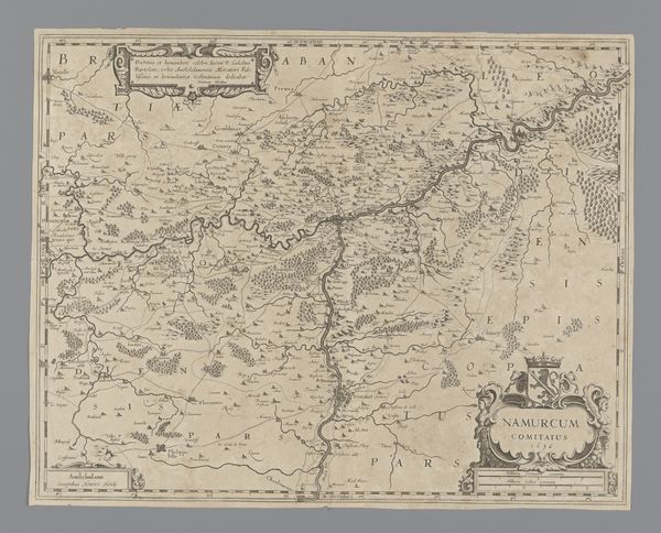
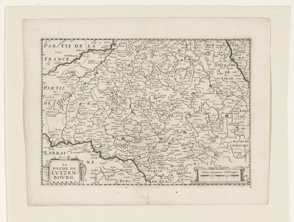
Curator: Before us, we have an etching dating back to 1689, titled "Kaart van het graafschap Namen," or "Map of the County of Namur." It resides here at the Rijksmuseum. Editor: At first glance, its visual austerity is compelling. The rigid linearity and precise delineation evoke a sense of almost obsessive control, don't you think? Curator: Indeed. What appears visually simplistic, however, belies the intricate dance of political and social forces underpinning its creation. This wasn't just about accurately depicting terrain; it was about establishing ownership, influence. Editor: Precisely! Note the strategic deployment of line, how it structures not merely space, but also power dynamics. The composition's rhythm, though muted in colour, conveys information hierarchically, inviting the viewer to decipher coded socio-political narratives. Curator: Consider, too, the style—undeniably Baroque. But observe how it diverges from the purely decorative, shifting towards the functional. Each mark contributes to a complex historical matrix. Editor: Let’s talk materials. Etching as a medium lends itself to duplication, facilitating the wide distribution of knowledge—or rather, a specific, carefully constructed version of it. The print, in its dissemination, asserts a particular view of this territory. Curator: Precisely. Maps were not neutral documents, but strategic instruments for managing and molding geopolitical realities. The very act of engraving Namur transformed the region into a knowable, manageable entity in the European imaginary. Editor: Examining how visual structure shapes our perceptions of the landscape's importance, it’s impossible not to appreciate the strategic importance of the land in 17th-century Europe. Curator: Absolutely. Its clean lines and factual depiction underscore the era's burgeoning sense of state control. An exploration of history through line and form. Editor: Yes. Thinking of how graphic language could act, perform, persuade... this etching offers more than one might have assumed from the apparent simplicity.
Comments
No comments
Be the first to comment and join the conversation on the ultimate creative platform.
More like this