drawing, print, paper, ink, engraving
#
drawing
#
pen drawing
# print
#
paper
#
ink
#
geometric
#
engraving
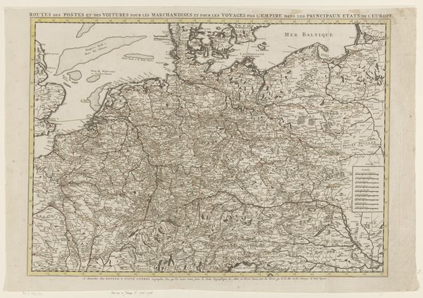
Dimensions: height 497 mm, width 580 mm
Copyright: Rijks Museum: Open Domain
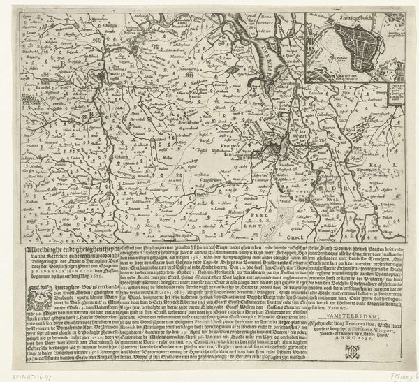
Curator: So, here we have "Kaart van de postroutes door het Duitse Rijk, 1711," created by Jacobus Harrewijn. It’s an intriguing engraving on paper. What strikes you first about it? Editor: It feels intensely practical, almost like a schematic. I’m thinking about the hands that held this map, probably smudged with ink and grime, actively planning journeys. There’s a functional beauty to it. Curator: Absolutely. This map wasn’t meant for aesthetic appreciation in a gallery; it was a working document. The materials are simple: ink, paper, the metal plate for engraving, but the labor... Can you imagine meticulously etching all those lines and place names? It speaks volumes about the value placed on communication in that era. Editor: The precision involved in the engraving—you see all the routes meticulously depicted across the landscape—it shows not only the physical landscape but also the imposed order of trade and power. It makes me consider the engraver's role less as artist and more as a kind of…technician. The work’s less about beauty than about dissemination of vital data. Curator: And yet, there’s an art to it. The flourishes in the cartouche, that delightful eagle holding the coat of arms—those weren't strictly necessary for wayfinding, were they? The maker found a way to assert artistry in a tool. Do you consider it to be beautiful, this utilitarian item? Editor: I think the beauty lies in its efficiency and comprehensiveness, the visual depiction of interconnectedness across a vast territory. Each stroke tells of workshops, smithies producing tools, travelers depending on horses or on foot for carrying the post and their baggage through muddy roads. It reminds me that all of those factors relied upon this sheet and what it represented, as a sort of control over vast territories. Curator: It truly bridges art, craft, and industry. A perfect example of information beautifully rendered, a material object teeming with cultural stories, both immediate and timeless. Thank you. Editor: Thank you, yes, what an engaging little lesson about craft, control, and the circulation of data!
Comments
No comments
Be the first to comment and join the conversation on the ultimate creative platform.
More like this