graphic-art, print, paper, engraving
#
graphic-art
#
dutch-golden-age
# print
#
landscape
#
paper
#
engraving
Dimensions: height 408 mm, width 299 mm
Copyright: Rijks Museum: Open Domain
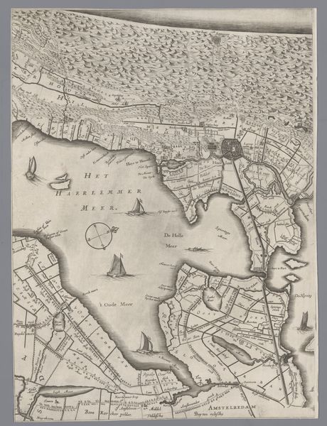
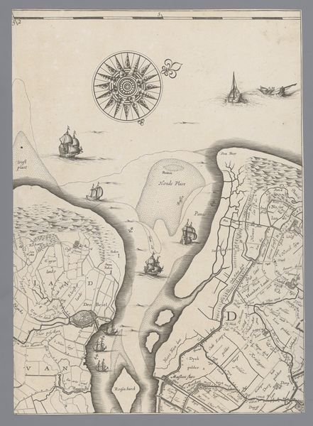
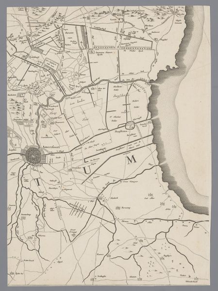
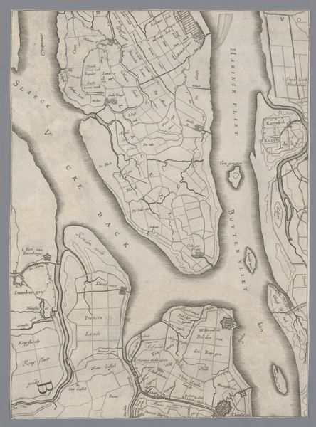
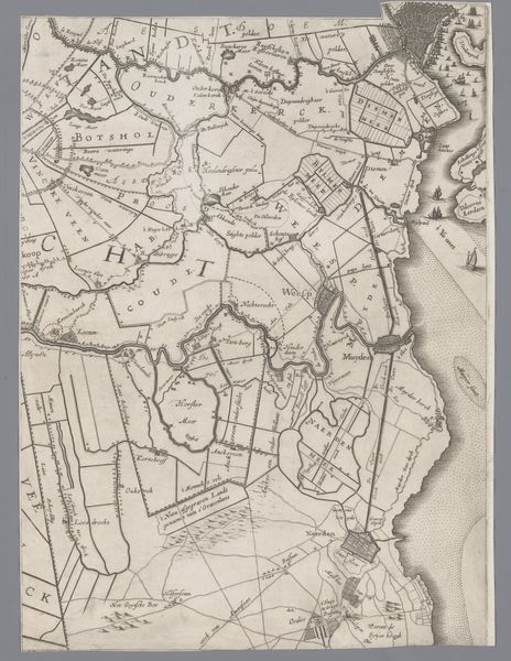
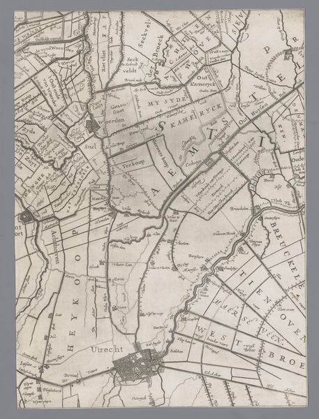
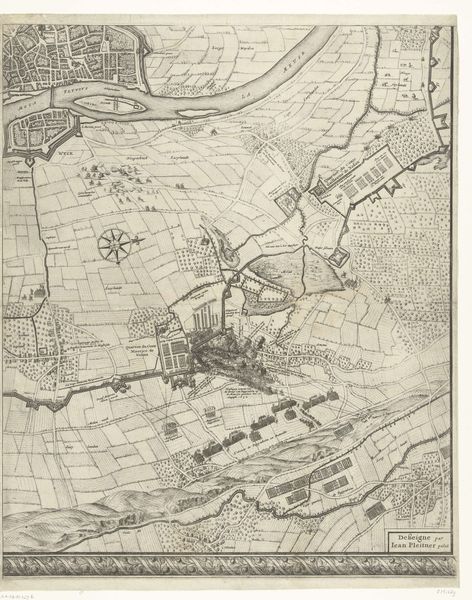
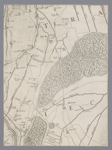
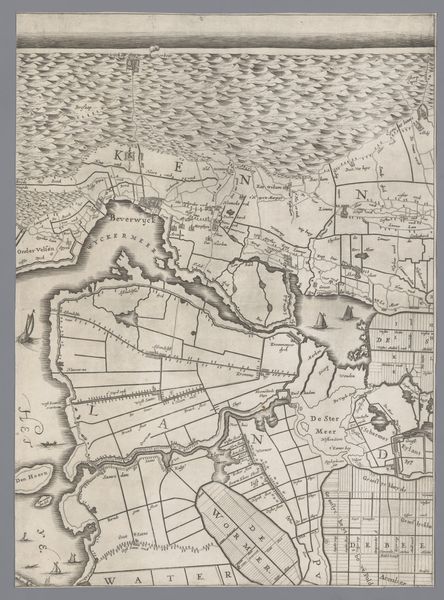
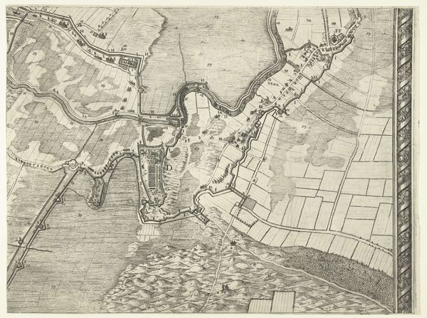
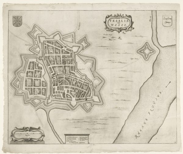
Curator: Let’s turn our attention to this fascinating 17th-century map from the Rijksmuseum, titled "Kaart van het Graafschap Holland en Utrecht" – "Map of the County of Holland and Utrecht" in English – created around 1639 by Jacob Aertsz. Colom. It is a Dutch Golden Age print on paper realized by engraving. Editor: My first impression is of its meticulous detail and the somber mood evoked by the monochrome palette. The density of lines and text create an almost textural experience. Curator: Absolutely. Look at how Colom employs engraving to delineate space, both geographically and politically. Maps, of course, are never neutral; they served a vital function in solidifying power. Here, we see Holland and Utrecht depicted, visualized in a way that asserts control. Who had access to this knowledge and how did it reinforce societal hierarchies of the time? Editor: Semiotically, each stroke contributes to the overall representation. Notice the balance of the composition – the weight of the landmass offset by the depiction of the sea, almost as if it suggests equilibrium. But the line work and subtle variations in shading across both elements construct a system for encoding place and conveying scale. Curator: It's crucial to remember that this was a period of intense transformation in the Netherlands, a rise in mercantile capitalism and colonial expansion. Consider how mapping was intrinsically linked to these power dynamics, laying the foundations for systems that still shape global inequalities today. The way in which it is laid out is definitely not a coincidence. Editor: A powerful insight. Observing, also, the cartouches and labels meticulously rendered throughout the landscape, we can explore the linguistic texture and structural systems through which the represented information is presented to its audiences. They serve as organizing frameworks which enable the visualization of its components within its composition. Curator: Ultimately, this map represents not only geographical spaces but also societal power structures during a formative period. Looking at this from a contemporary perspective offers us the chance to recognize mapping not just as objective records, but as dynamic interpretations. Editor: And understanding the map through formal elements reveals how the aesthetic principles, materials, and semiotics play vital roles in mediating between subject and understanding—the foundations through which we extract our interpretations and impressions.
Comments
No comments
Be the first to comment and join the conversation on the ultimate creative platform.
More like this