print, etching, engraving
#
type repetition
#
aged paper
#
toned paper
# print
#
etching
#
old engraving style
#
hand drawn type
#
etching
#
pen work
#
cityscape
#
script guideline
#
engraving
#
historical font
#
columned text
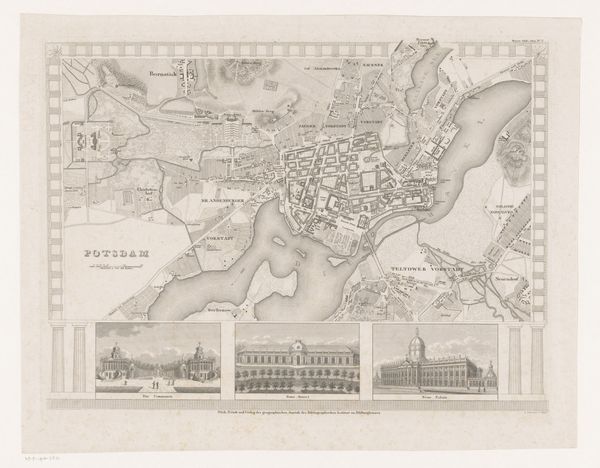
Dimensions: height 302 mm, width 392 mm
Copyright: Rijks Museum: Open Domain
This is B. Metzeroth's "Plattegrond van Berlijn", a city map of Berlin, meticulously rendered as an engraving. The map presents Berlin as an ordered, rational space. Its neat grid-like layout suggests an ambition to manage and control urban life. Made during a period of significant urban expansion in Berlin, this map isn't just a neutral document; it's a statement about power and progress. The city is presented as a place of commerce, civic administration, and military power. Note how the map highlights key landmarks like the palaces and military structures, emphasizing the values of the Prussian state. Looking closely at the map can tell us about the social hierarchy of the time, the distribution of wealth and resources, and even the cultural values of the city's elite. Comparing it to other historical documents, we might explore how the image of Berlin was strategically crafted and disseminated.
Comments
No comments
Be the first to comment and join the conversation on the ultimate creative platform.
More like this