drawing, print, pen, engraving
drawing
rippled sketch texture
aged paper
baroque
pen drawing
pen sketch
old engraving style
personal sketchbook
pen-ink sketch
pen work
sketchbook drawing
pen
cityscape
coloring book page
engraving
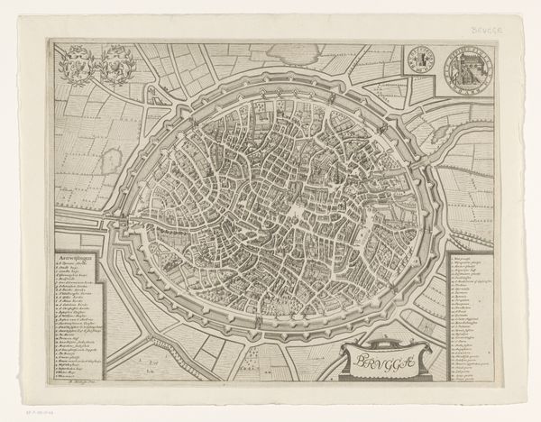
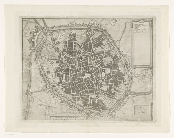
Dimensions: height 392 mm, width 480 mm
Copyright: Rijks Museum: Open Domain
This plan of Bruges was made by Isaac Basire sometime before 1768, using the technique of engraving. Engraving is an intaglio process, meaning that the image is incised into a surface – in this case, a metal plate – and then filled with ink. The plate is then pressed onto paper, transferring the image. Look closely, and you’ll see the crisp lines, the product of a deliberate hand. The making of such a detailed map involved considerable labour. Not only in the surveying and drafting required to accurately represent the city, but also in the skilled execution of the engraving itself. Basire would have used specialized tools to carve the fine lines, demanding precision and control. These kinds of maps were not just representations, they were also tools of power, reflecting a desire to survey, organize, and control space. By understanding the labor and skill involved in its production, we can appreciate this plan not just as a document, but as a material artifact.
Comments
No comments
Be the first to comment and join the conversation on the ultimate creative platform.