graphic-art, print, engraving
#
graphic-art
#
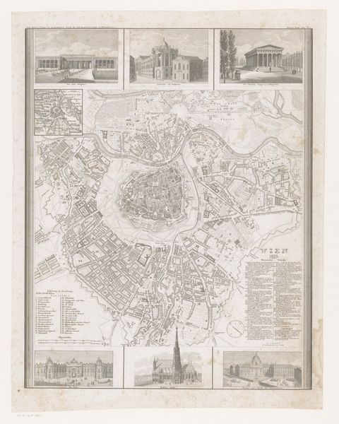
neoclacissism
# print
#
cityscape
#
engraving
Dimensions: height 270 mm, width 355 mm
Copyright: Rijks Museum: Open Domain
This detailed map of Potsdam, created by J. Zipter, showcases not just geography, but the city's essence through architectural motifs. At the bottom of the image, three iconic buildings stand as symbols of power, progress, and cultural identity. We see their classical design, mirroring the Renaissance ideals of harmony and proportion. Columns, a prominent feature, serve as both structural supports and as cultural symbols evoking notions of order and reason. These architectural choices, reminiscent of ancient Greek temples, link Potsdam to a long lineage of power and intellectual heritage. Similar columns appear in Roman triumphal arches, meant to commemorate military victories and the might of empires. These symbols endure. They are repeated and reinterpreted across centuries, each time layered with new meanings and emotional resonance, a palimpsest of human ambition and memory. In viewing this map, we are reminded that symbols do not exist in isolation but are part of an evolving, cyclical procession, endlessly resurrected and transformed through time.
Comments
No comments
Be the first to comment and join the conversation on the ultimate creative platform.
More like this