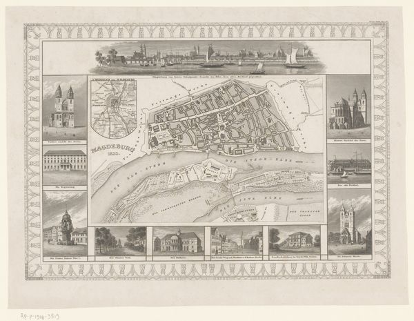
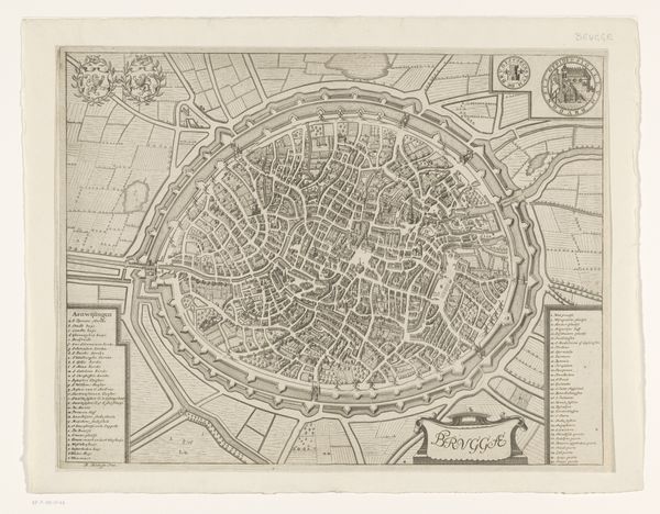
Plattegrond van Dresden met gezichten op gebouwen in de stad 1728 - 1774
0:00
0:00
bibliographischesinstitut
Rijksmuseum
print, etching, engraving
#
baroque
# print
#
etching
#
etching
#
cityscape
#
engraving
Dimensions: height 261 mm, width 355 mm
Copyright: Rijks Museum: Open Domain
Curator: Here we have an intriguing piece titled "Plattegrond van Dresden met gezichten op gebouwen in de stad," which translates to "Map of Dresden with views of buildings in the city," dating from 1728 to 1774. It comes to us from the Bibliographisches Institut and currently resides at the Rijksmuseum. Editor: At first glance, it strikes me as exceptionally ordered—a meticulously crafted representation. The restrained palette accentuates the density of architectural forms, lending it a somber yet precise character. Curator: Precisely. It is an engraving and etching, demonstrating remarkable technical skill. These printmaking techniques allow for a high level of detail. Note how the city plan is not presented in isolation; it's framed by illustrative vignettes of key buildings. These elevations give us, the viewers, a dual perspective. Editor: Those building views create a visual rhythm around the central map, providing more than mere cartography. They also function as portraits, celebrating the city’s architectural identity. Do you think that serves a propagandistic purpose? To showcase Dresden’s grandeur? Curator: It would not be incorrect to infer that there may have been political intent behind such elaborate documentation. City maps in this era functioned as representations of power, civic pride, and, in a practical sense, an understanding of the city's layout and governance. By showing prominent landmarks and public buildings it could have very well shown its authority and social structuring to its populace and neighbors. Editor: I wonder if this map functioned beyond officialdom; perhaps citizens used it to navigate the streets or tourists relied on it to see landmarks. The level of detailing here—down to individual buildings and the layout of gardens—feels immensely useful, practical, as much as symbolic. Curator: Without a doubt, the detail suggests utility, aligning with the burgeoning Enlightenment interest in documentation and empirical knowledge. Its function goes beyond the purely symbolic and it is to engage practically within Dresden society. The level of minute details, down to representing different types of vegetation alongside a building, emphasizes this. Editor: The cross-referencing between map view and architectural elevations makes the composition so dynamic—like seeing Dresden both abstractly and concretely. I appreciate the tension between the order of the map and the visual variety introduced by its details and surrounding elements. Curator: I find it particularly striking how the artist uses this measured approach to give order and coherence to urban sprawl. Editor: And perhaps, order to Dresden society in those very unstable historical times. It makes you wonder what stories those streets, captured in ink, might have told then, and could tell now, if they could talk.
Comments
No comments
Be the first to comment and join the conversation on the ultimate creative platform.
More like this