lithograph, print, paper
#
lithograph
# print
#
asian-art
#
landscape
#
paper
#
geometric
Dimensions: height 400 mm, width 535 mm
Copyright: Rijks Museum: Open Domain
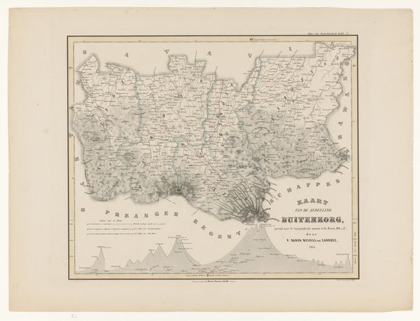
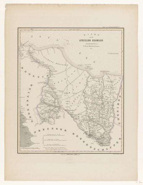
F. Cronenberg created this map of the Residency of Batavia on Java. It offers us a window into the Dutch colonial administration in the East Indies. Cartography was a key tool for colonial powers. It visually claimed territory and helped organize resources. This map, with its detailed rendering of Batavia, now Jakarta, and the surrounding areas, illustrates that impulse. The careful labeling of regions, roads, and administrative divisions served the interests of the Dutch East India Company, or VOC. The VOC sought to maximize its control over the lucrative spice trade and other resources. To truly understand this map, we can investigate the VOC archives, study colonial administrative records, and analyze the economic history of the region. In doing so, we see how the act of mapping was both a reflection of and an instrument for exercising power. It’s a reminder that the images we see are never neutral. They're always embedded in a social and institutional context.
Comments
No comments
Be the first to comment and join the conversation on the ultimate creative platform.
More like this